Castellane, Alpes-de-Haute-Provence, Zu Fuß: Die besten Touren, Trails, Trecks und Wanderungen

14 kommentare

Castellane : Entdecken Sie die besten Touren : 11 zu fuß, 126 wandern und 1 laufen. Alle diese Touren, Trails, Routen und Outdoor-Aktivitäten sind in unseren SityTrail-Apps für Smartphones und Tablets verfügbar.


Die besten Spuren (138)

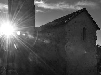
Tour Wandern Castellane - Sentier des Siréniens  - Photo
Wandern 3.83
Km

Wandern

Sehr leicht
(1)
Castellane, Provence-Alpes-Côte d'Azur, Alpes-de-Haute-Provence, France
3,8 km | 5,5 km-effort
1h 9min
122 m
121 m
Ja
Dervalmarc

• Sentier original. Thématique sur les roches et les fossiles mis en place par la réserve géologique. Très beaux aména...
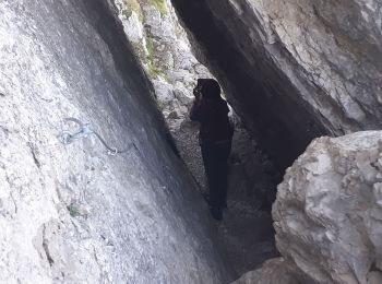
Tour Wandern Castellane - cadiere de brandis - Photo
Wandern 8.927
Km

Wandern

Sehr leicht
(1)
Castellane, Provence-Alpes-Côte d'Azur, Alpes-de-Haute-Provence, France
8,9 km | 14,6 km-effort
2h 27min
428 m
423 m
Nein
choux83

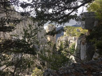
Tour Wandern Castellane - La Baume-Ruines du Vieux Courchons - Photo
Wandern 12.215
Km

Wandern

Schwierig
(1)
Castellane, Provence-Alpes-Côte d'Azur, Alpes-de-Haute-Provence, France
12,2 km | 18,5 km-effort
4h 11min
469 m
468 m
Ja
Salomi

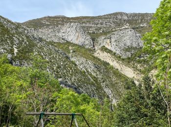
Tour Wandern Castellane - Cadières de Brandis - Photo
Wandern 10.727
Km

Wandern

Medium
(1)
Castellane, Provence-Alpes-Côte d'Azur, Alpes-de-Haute-Provence, France
10,7 km | 18,4 km-effort
3h 51min
578 m
575 m
Ja
jmheydorff

Tour Wandern Castellane - castellane - Photo
Wandern 4.718
Km

Wandern

Medium
Castellane, Provence-Alpes-Côte d'Azur, Alpes-de-Haute-Provence, France
4,7 km | 8 km-effort
1h 26min
246 m
245 m
Ja
RoMo

Tour Wandern Castellane - La Colle : Cadières de Brandis - Photo
Wandern 17.478
Km

Wandern

Schwierig
Castellane, Provence-Alpes-Côte d'Azur, Alpes-de-Haute-Provence, France
17,5 km | 30 km-effort
6h 54min
969 m
968 m
Ja
ETMU5496

Tour Wandern Castellane - Thyrs : sommet du Robion - Photo
Wandern 14.649
Km

Wandern

Schwierig
Castellane, Provence-Alpes-Côte d'Azur, Alpes-de-Haute-Provence, France
14,6 km | 28 km-effort
6h 16min
977 m
972 m
Ja
ETMU5496

Tour Wandern Castellane - 2023-10-27 Sommet de Destourbes - Photo
Wandern 13.573
Km
GUIDE

Wandern

Schwierig
Castellane, Provence-Alpes-Côte d'Azur, Alpes-de-Haute-Provence, France
13,6 km | 24 km-effort
5h 33min
817 m
818 m
Ja
Kargil

Tour Wandern Castellane - Clot d'Aremus - Chasteuil - Chapelle St Jean - Castellane - Photo
Wandern 14.303
Km

Wandern

Einfach
Castellane, Provence-Alpes-Côte d'Azur, Alpes-de-Haute-Provence, France
14,3 km | 19,8 km-effort
3h 54min
424 m
372 m
Nein
LtZIP

Tour Wandern Castellane - Col des lèques - Cadières de branlis - Photo
Wandern 7.762
Km

Wandern

Schwierig
Castellane, Provence-Alpes-Côte d'Azur, Alpes-de-Haute-Provence, France
7,8 km | 13,4 km-effort
3h 2min
424 m
424 m
Ja
RayFab

Tour Wandern Castellane - Castelane - Photo
Wandern 11.871
Km

Wandern

Sehr leicht
Castellane, Provence-Alpes-Côte d'Azur, Alpes-de-Haute-Provence, France
11,9 km | 21 km-effort
6h 48min
679 m
810 m
Nein
avdem

Tour Wandern Castellane - Chasteuil (04) ; Cadières de Brandis - Photo
Wandern 18.271
Km

Wandern

Schwierig
Castellane, Provence-Alpes-Côte d'Azur, Alpes-de-Haute-Provence, France
18,3 km | 33 km-effort
5h 13min
1122 m
1121 m
Ja
ETMU5496

Tour Wandern Castellane - Castellane - Chapelle St Thyrs - Petit Robion - Sommet Robion - Gorges du Rayaup - Photo
Wandern 15.152
Km

Wandern

Schwierig
Castellane, Provence-Alpes-Côte d'Azur, Alpes-de-Haute-Provence, France
15,2 km | 28 km-effort
4h 26min
979 m
981 m
Ja
LtZIP

Tour Wandern Castellane - Cadières  de Brandis version Light - Photo
Wandern 9.235
Km

Wandern

Schwierig
Castellane, Provence-Alpes-Côte d'Azur, Alpes-de-Haute-Provence, France
9,2 km | 15,4 km-effort
3h 0min
460 m
460 m
Ja
donda

Tour Wandern Castellane - Cadières de Brandis - Photo
Wandern 8.829
Km

Wandern

Schwierig
Castellane, Provence-Alpes-Côte d'Azur, Alpes-de-Haute-Provence, France
8,8 km | 14,8 km-effort
3h 17min
451 m
452 m
Ja
lviallet

Tour Wandern Castellane - Chasteuil - Cadières de Brandis - Photo
Wandern 18.504
Km

Wandern

Schwierig
Castellane, Provence-Alpes-Côte d'Azur, Alpes-de-Haute-Provence, France
18,5 km | 34 km-effort
5h 11min
1145 m
1151 m
Ja
ETMU5496

Tour Wandern Castellane - Castellane-Cadieres de Brandis - Photo
Wandern 10.39
Km

Wandern

Medium
Castellane, Provence-Alpes-Côte d'Azur, Alpes-de-Haute-Provence, France
10,4 km | 16,5 km-effort
3h 33min
458 m
458 m
Ja
Sugg

• Rando avec Pierre

Tour Wandern Castellane - col de Leque - Photo
Wandern 8.203
Km

Wandern

Sehr leicht
(1)
Castellane, Provence-Alpes-Côte d'Azur, Alpes-de-Haute-Provence, France
8,2 km | 13,9 km-effort
3h 20min
429 m
428 m
Ja
patsure

• avec Patricia

Tour Wandern Castellane - La Voie Impériale (Etape 1 : Castellane - Senez) - Photo
Wandern 18.348
Km

Wandern

Schwierig
Castellane, Provence-Alpes-Côte d'Azur, Alpes-de-Haute-Provence, France
18,3 km | 29 km-effort
6h 0min
782 m
724 m
Nein
tracegps

Tour Wandern Castellane - robion castellane 1226m 15k - Photo
Wandern 13.869
Km

Wandern

Sehr schwierig
Castellane, Provence-Alpes-Côte d'Azur, Alpes-de-Haute-Provence, France
13,9 km | 27 km-effort
7h 50min
1010 m
1013 m
Ja
Danielba

20 Angezeigte Touren bei 138

Kostenlosegpshiking-Anwendung

Logo SityTrail SityTrail

IGN / Geografische Institute

SityTrail aus dem App Store herunterladen SityTrail von Google Play herunterladen

Logo SityTrail SityTrail World

Die Welt öffnet sich für Sie

SityTrail aus dem App Store herunterladen SityTrail von Google Play herunterladen SityTrail auf Huawei AppGallery herunterladen

Aktivitäten

Schließen
Meine Abonnements