![](/images/other/stat-length.png)
![Tour Wandern Belforêt-en-Perche - Chêne séculaire - Bellême - Photo](https://media.geolcdn.com/t/1900/400/ext.pjpeg?maxdim=2&url=https%3A%2F%2Fservices.sitytrail.com%2FGeolivesWS%2FDownloadMedia.ashx%3FTrailID%3D111658%26Media%3D7896_2.jpg)
Chêne séculaire - Bellême
tracegps
Benutzer
![Länge](/images/other/stat-length.png)
Länge
9,3 km
![Maximale Höhe](https://static1.geolcdn.com/siteimages/upload/files/1508320355ic_sort_altitude_max_24dp.png)
Maximale Höhe
256 m
![Positive Höhendifferenz](https://static1.geolcdn.com/siteimages/upload/files/1508320355ic_sort_den_pos_24dp.png)
Positive Höhendifferenz
183 m
![Km-Effort](/images/other/stat-length.png)
Km-Effort
11,8 km
![Min. Höhe](https://static1.geolcdn.com/siteimages/upload/files/1508320355ic_sort_altitude_min_24dp.png)
Min. Höhe
164 m
![Negative Höhendifferenz](https://static1.geolcdn.com/siteimages/upload/files/1508320355ic_sort_den_neg_24dp.png)
Negative Höhendifferenz
196 m
![Boucle](https://static1.geolcdn.com/siteimages/upload/files/16400158638029165_repeat_loop_refresh_sync_direction_icon.png)
Boucle
Ja
Erstellungsdatum :
2014-12-10 00:00:00.0
Letzte Änderung :
2014-12-10 00:00:00.0
![Wandern](https://static1.geolcdn.com/sitytour/trail-icons/101.png)
3h30
Schwierigkeit : Medium
![Scannen Sie diesen QR-Code, um die Tour in der SityTrail-Anwendung zu öffnen](https://capi.geolives.com/qq0zvz2zws4bq2lad0pu/sitytour/trails/111658/qr.png?size=200)
Kostenlosegpshiking-Anwendung
Über SityTrail
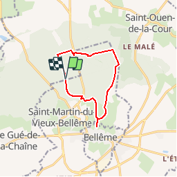
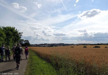
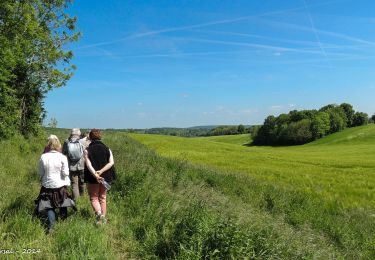
Tour Wandern von 9,3 km verfügbar auf Normandie, Orne, Belforêt-en-Perche. Diese Tour wird von tracegps vorgeschlagen.
Beschreibung
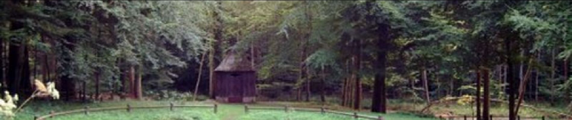
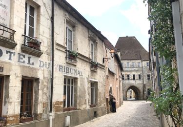
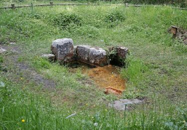
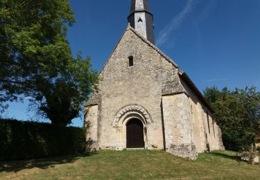
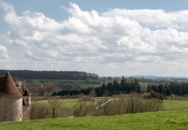
Chêne séculaire – Bellême Découvrez un pittoresque parcours forestier, agrémenté par l'étang de la Herse et sa fontaine miraculeuse. Retrouvez les Coup de Cœur Randonnée dans l’Orne en Normandie.
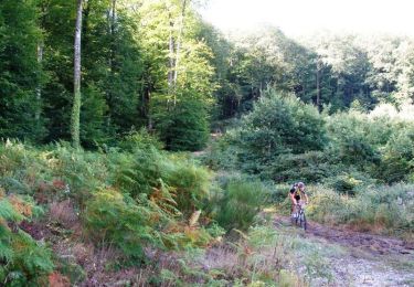
Ort
Land:
France
Region :
Normandie
Abteilung/Provinz :
Orne
Kommune :
Belforêt-en-Perche
Standort:
Eperrais
Gehen Sie:(Dec)
Gehen Sie:(UTM)
318331 ; 5363052 (31U) N.
Kommentare
Touren in der Umgebung
![Tour Mountainbike Bellême - La Bell'Rando 2005 - Photo](https://media.geolcdn.com/t/375/260/ext.jpg?maxdim=2&url=https%3A%2F%2Fservices.sitytrail.com%2FGeolivesWS%2FDownloadMedia.ashx%3FTrailID%3D101083%26Media%3D573_2.jpg)
![Mountainbike Mountainbike](https://static1.geolcdn.com/sitytour/trail-icons/202.png)
La Bell'Rando 2005
Mountainbike
Sehr schwierig
(1)
Bellême,
Normandie,
Orne,
France
![](/images/other/stat-length.png)
50 km | 64 km-effort
3h 15min
![](https://static1.geolcdn.com/siteimages/upload/files/16400158638029165_repeat_loop_refresh_sync_direction_icon.png)
Ja
![Tour Rennrad Saint-Martin-du-Vieux-Bellême - Bellême-Mortagne V2 - Photo](https://media.geolcdn.com/t/375/260/ext.jpg?maxdim=2&url=https%3A%2F%2Fmedia.geolcdn.com%2Ff%2F29bc319b-a0d8-4693-b18c-8bf77c8f4a9b.jpg)
![Rennrad Rennrad](https://static1.geolcdn.com/sitytour/trail-icons/201.png)
Bellême-Mortagne V2
Rennrad
Medium
Saint-Martin-du-Vieux-Bellême,
Normandie,
Orne,
France
![](/images/other/stat-length.png)
66 km | 79 km-effort
5h 25min
![](https://static1.geolcdn.com/siteimages/upload/files/16400158638029165_repeat_loop_refresh_sync_direction_icon.png)
Ja
![Tour Zu Fuß Saint-Martin-du-Vieux-Bellême - Chêne séculaire - Photo](https://media.geolcdn.com/t/375/260/ext.jpg?maxdim=2&url=https%3A%2F%2Fmedia.geolcdn.com%2Ff%2F1e7dc81d-cfa6-49bd-86cc-f4a86c5edf07.jpeg)
![Zu Fuß Zu Fuß](https://static1.geolcdn.com/sitytour/trail-icons/100.png)
Chêne séculaire
Zu Fuß
Einfach
Saint-Martin-du-Vieux-Bellême,
Normandie,
Orne,
France
![](/images/other/stat-length.png)
9,2 km | 11,8 km-effort
2h 40min
![](https://static1.geolcdn.com/siteimages/upload/files/16400158638029165_repeat_loop_refresh_sync_direction_icon.png)
Nein
![Tour Elektrofahrrad Bellême - circuit des vallées bellemoises - Photo](https://media.geolcdn.com/t/375/260/ext.jpg?maxdim=2&url=https%3A%2F%2Fmedia.geolcdn.com%2Ff%2F8942d37a-44b6-4034-87b6-86b0b9a49d8c.jpg)
![Elektrofahrrad Elektrofahrrad](https://static1.geolcdn.com/sitytour/trail-icons/205.png)
circuit des vallées bellemoises
Elektrofahrrad
Einfach
Bellême,
Normandie,
Orne,
France
![](/images/other/stat-length.png)
44 km | 52 km-effort
4h 48min
![](https://static1.geolcdn.com/siteimages/upload/files/16400158638029165_repeat_loop_refresh_sync_direction_icon.png)
Ja
![Tour Wandern Bellême - Bellême - Mortagne-au-Perche 23 km - Photo](https://media.geolcdn.com/t/375/260/ext.jpg?maxdim=2&url=https%3A%2F%2Fmedia.geolcdn.com%2Ff%2F648b0c04-c9f6-4954-a7eb-873b2f717454.jpg)
![Wandern Wandern](https://static1.geolcdn.com/sitytour/trail-icons/101.png)
Bellême - Mortagne-au-Perche 23 km
Wandern
Sehr schwierig
Bellême,
Normandie,
Orne,
France
![](/images/other/stat-length.png)
23 km | 27 km-effort
6h 17min
![](https://static1.geolcdn.com/siteimages/upload/files/16400158638029165_repeat_loop_refresh_sync_direction_icon.png)
Nein
![Tour Wandern Bellême - Bellême - Nocé/Courboyer 17 km - Photo](https://media.geolcdn.com/t/375/260/ext.jpg?maxdim=2&url=https%3A%2F%2Fmedia.geolcdn.com%2Ff%2F0a669ee2-665f-435c-8b9c-5b0346d2e0a4.jpg)
![Wandern Wandern](https://static1.geolcdn.com/sitytour/trail-icons/101.png)
Bellême - Nocé/Courboyer 17 km
Wandern
Einfach
Bellême,
Normandie,
Orne,
France
![](/images/other/stat-length.png)
16,6 km | 20 km-effort
3h 24min
![](https://static1.geolcdn.com/siteimages/upload/files/16400158638029165_repeat_loop_refresh_sync_direction_icon.png)
Nein
![Tour Wandern Bellême - Traversées Percheronnes Bellême - Gémages 15,4 Km - Photo](https://media.geolcdn.com/t/375/260/ext.jpg?maxdim=2&url=https%3A%2F%2Fmedia.geolcdn.com%2Ff%2F23f7282d-ffa3-4b2e-a94a-5dc4af001232.jpg)
![Wandern Wandern](https://static1.geolcdn.com/sitytour/trail-icons/101.png)
Traversées Percheronnes Bellême - Gémages 15,4 Km
Wandern
Medium
Bellême,
Normandie,
Orne,
France
![](/images/other/stat-length.png)
15,4 km | 17,6 km-effort
4h 2min
![](https://static1.geolcdn.com/siteimages/upload/files/16400158638029165_repeat_loop_refresh_sync_direction_icon.png)
Nein
![Tour Wandern Bellême - Bellême - La Perrière 12 km - Photo](https://media.geolcdn.com/t/375/260/ext.jpg?maxdim=2&url=https%3A%2F%2Fmedia.geolcdn.com%2Ff%2Fb423f935-0a19-479d-aaad-bc5a9bf55dc8.jpg)
![Wandern Wandern](https://static1.geolcdn.com/sitytour/trail-icons/101.png)
Bellême - La Perrière 12 km
Wandern
Medium
Bellême,
Normandie,
Orne,
France
![](/images/other/stat-length.png)
12,1 km | 15,4 km-effort
3h 20min
![](https://static1.geolcdn.com/siteimages/upload/files/16400158638029165_repeat_loop_refresh_sync_direction_icon.png)
Nein
![Tour Wandern Bellême - Bellême - Mauves-sur-Huisne 14 km - Photo](https://media.geolcdn.com/t/375/260/ext.jpg?maxdim=2&url=https%3A%2F%2Fmedia.geolcdn.com%2Ff%2Fbd52a7c3-ac84-428f-b134-e425824892a0.jpg)
![Wandern Wandern](https://static1.geolcdn.com/sitytour/trail-icons/101.png)
Bellême - Mauves-sur-Huisne 14 km
Wandern
Einfach
Bellême,
Normandie,
Orne,
France
![](/images/other/stat-length.png)
13,8 km | 16,5 km-effort
5h 40min
![](https://static1.geolcdn.com/siteimages/upload/files/16400158638029165_repeat_loop_refresh_sync_direction_icon.png)
Nein
une balade bien sympathique
Ballade assez sympathique avec un étang très joli et de beaux passages en forêt.