Tour Wandern Noisy-sur-École - M&R-121118 - 250Marches - Photo
 randodan
randodan

Benutzer

© OpenStreetMap contributors
Länge
Länge
14,3 km
Maximale Höhe
Maximale Höhe
131 m
Positive Höhendifferenz
282 m
Km-Effort
Km-Effort  
18,1 km
Min. Höhe
Min. Höhe
74 m
Negative Höhendifferenz
284 m
Boucle
Boucle
Ja
Erstellungsdatum :
2014-12-10 00:00:00.0
Letzte Änderung :
2014-12-10 00:00:00.0

(1 Nachricht)

Wandern
Wandern
3h50
Schwierigkeit : Einfach

Scannen Sie diesen QR-Code, um die Tour in der SityTrail-Anwendung zu öffnen

Kostenlosegpshiking-Anwendung

Logo SityTrail SityTrail

IGN / Geografische Institute

SityTrail aus dem App Store herunterladen SityTrail von Google Play herunterladen

Logo SityTrail SityTrail Plus

Die Welt öffnet sich für Sie

SityTrail aus dem App Store herunterladen SityTrail von Google Play herunterladen SityTrail auf Huawei AppGallery herunterladen

Über SityTrail

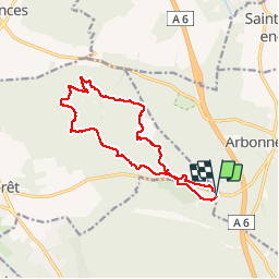
Tour Wandern von 14,3 km verfügbar auf Île-de-France, Seine-et-Marne, Noisy-sur-École. Diese Tour wird von randodan vorgeschlagen.

Beschreibung

250 marches avec Marche et Rêve - 18 novembre 2012 .<br>
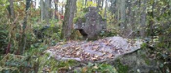
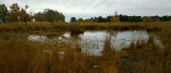
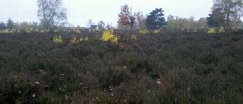
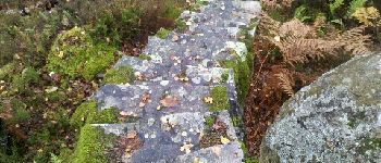
Départ du parking de la Feuillardière, 9h30. Le Chapeau de Napoléon en ´´RTT´´, le Chemin officiel des ´´Cent Marches´´ traversant des propriétés qui se déclarent ´´privées´´, petite mare dans la lande de calunes . Descente dans les feuilles mortes menant à quelques vestiges de carriers, rails et wagonnet .<br>
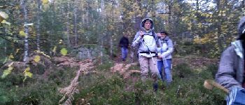
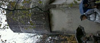
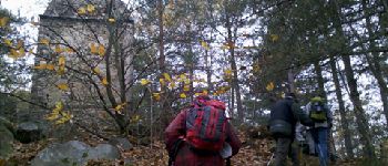
11h40, pause sur le Montrouget , on en redescend à nouveau en ´´RTT´´ . Le pique-nique était prévu aux ouvrages de l´aqueduc en parcelle 32, mais la pluie fine nous pousse à trouver un abri plus loin .<br>
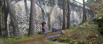
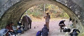
12h20, à l´abri sous une arche de l´aqueduc pour le pique-nique . Au menu : Père La Grolle nouveau et Irancy 2008 .<br>
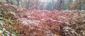
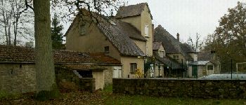
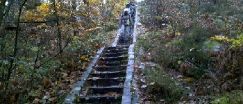
La pluie toujours finement présente, un petit bout de ´´RTT´´ nous mène à la Mare de Coquibus . La Ferme de Coquibus, le Chemin (goudronné) du Nid d´Aigle, et nous arrivons vers 14h en haut des 100 premières marches . Après quoi, une 2e volée - hors piste celle-là - de 146 marches .<br>
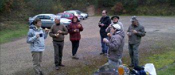
15h30 au parking pour le cidre et le gâteau de Marion .

Höhenprofil

Foto-Galerie

POIs

POI Milly-la-Forêt - 02 - Les Grandes Vallées - Photo
randodan
MILLY-LA-FORÊT 
POI Milly-la-Forêt - 03 - Les Grandes Vallées - Photo
randodan
MILLY-LA-FORÊT 
POI Milly-la-Forêt - 04 - Rochers aux Voleurs - Photo
randodan
MILLY-LA-FORÊT 
POI Milly-la-Forêt - 05 - Rochers aux Voleurs - Photo
randodan
MILLY-LA-FORÊT 
POI Milly-la-Forêt - 06 - Platière de Coquibus (Est) - Photo
randodan
POI Milly-la-Forêt - 07 - Platière de Coquibus (Est) - Photo
randodan
POI Milly-la-Forêt - 08 - Montrouget - Photo
randodan
MILLY-LA-FORÊT 
POI Milly-la-Forêt - 09 - Montrouget - Photo
randodan
MILLY-LA-FORÊT 
POI Milly-la-Forêt - 10 - Les Arcades - Photo
randodan
MILLY-LA-FORÊT 
POI Milly-la-Forêt - 12 - La Roche-qui-tourne - Photo
randodan
MILLY-LA-FORÊT 
POI Milly-la-Forêt - 13 - Platière de Coquibus (Ouest) - Photo
randodan
POI Milly-la-Forêt - 14 - Platière de Coquibus (Ouest) - Photo
randodan
POI Milly-la-Forêt - 15 - Platière de Coquibus (Ouest) - Photo
randodan
POI Milly-la-Forêt - 16 - Platière de Coquibus (Sud-Ouest) - Photo
randodan
POI Milly-la-Forêt - 17 - Les CENT Marches - Photo
randodan
MILLY-LA-FORÊT 
POI Milly-la-Forêt - 18 - Les cent AUTRES Marches (hors sentier) - Photo
randodan
POI Milly-la-Forêt - 01 - Chapeau de Napoléon - Photo
randodan
MILLY-LA-FORÊT 
POI Milly-la-Forêt - 11 - Les Arcades - Photo
randodan
MILLY-LA-FORÊT 
POI Noisy-sur-École - 19 - Au parking - Photo
randodan
NOISY-SUR-ÉCOLE 
POI Milly-la-Forêt - En bonus, quelques sites intéressants à visiter - Photo
randodan

Ort

Land:
France
Region :
Île-de-France
Abteilung/Provinz :
Seine-et-Marne
Kommune :
Noisy-sur-École
Standort:
Unknown
Gehen Sie:(Dec)
Gehen Sie:(UTM)
466399 ; 5360982 (31U) N.

Kommentare

Bitte melden Sie sich an, um einen Kommentar oder eine Bewertung zu hinterlassen


Schließen
Meine Abonnements