![](/images/other/stat-length.png)
![Tour Andere Aktivitäten Alberswil - Ausritt Tennisplatz - Photo](https://media.geolcdn.com/t/1900/400/ext.pjpeg?maxdim=2&url=https%3A%2F%2Fstatic1.geolcdn.com%2Fsiteimages%2Fupload%2Ffiles%2F1545311037marcheuse_200dpi.jpg)
Ausritt Tennisplatz
markus
Benutzer
![Länge](/images/other/stat-length.png)
Länge
7,2 km
![Maximale Höhe](https://static1.geolcdn.com/siteimages/upload/files/1508320355ic_sort_altitude_max_24dp.png)
Maximale Höhe
570 m
![Positive Höhendifferenz](https://static1.geolcdn.com/siteimages/upload/files/1508320355ic_sort_den_pos_24dp.png)
Positive Höhendifferenz
119 m
![Km-Effort](/images/other/stat-length.png)
Km-Effort
8,8 km
![Min. Höhe](https://static1.geolcdn.com/siteimages/upload/files/1508320355ic_sort_altitude_min_24dp.png)
Min. Höhe
505 m
![Negative Höhendifferenz](https://static1.geolcdn.com/siteimages/upload/files/1508320355ic_sort_den_neg_24dp.png)
Negative Höhendifferenz
119 m
![Boucle](https://static1.geolcdn.com/siteimages/upload/files/16400158638029165_repeat_loop_refresh_sync_direction_icon.png)
Boucle
Ja
Erstellungsdatum :
2014-12-11 00:00:00.0
Letzte Änderung :
2014-12-11 00:00:00.0
![Andere Aktivitäten](https://static1.geolcdn.com/sitytour/trail-icons/900.png)
--
Schwierigkeit : Unbekannt
![Scannen Sie diesen QR-Code, um die Tour in der SityTrail-Anwendung zu öffnen](https://capi.geolives.com/qq0zvz2zws4bq2lad0pu/sitytour/trails/19391/qr.png?size=200)
Kostenlosegpshiking-Anwendung
Über SityTrail
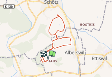
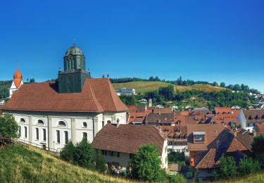
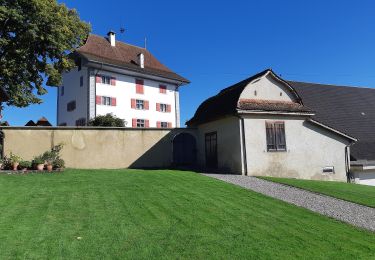
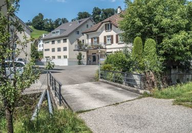
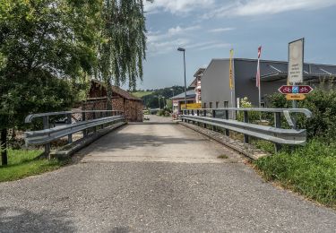
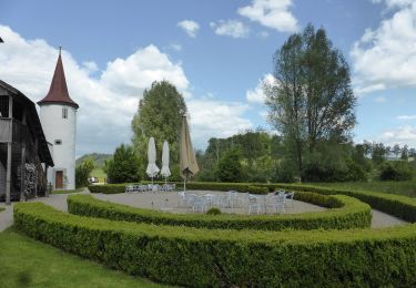
Tour Andere Aktivitäten von 7,2 km verfügbar auf Luzern, Unbekannt, Alberswil. Diese Tour wird von markus vorgeschlagen.
Beschreibung
Wenn mann Sonne braucht ist dass der richtige Ritt.
Ich binn alles schritt geritten.
Es hat aber auch Trab- und Galopp- strecken dabei.
Ort
Land:
Switzerland
Region :
Luzern
Abteilung/Provinz :
Unbekannt
Kommune :
Alberswil
Standort:
Unknown
Gehen Sie:(Dec)
Gehen Sie:(UTM)
423183 ; 5222070 (32T) N.
Kommentare
Touren in der Umgebung
![Tour Zu Fuß Willisau - Obere Stalde - Willisau - Photo](https://media.geolcdn.com/t/375/260/ext.jpg?maxdim=2&url=https%3A%2F%2Fmedia.geolcdn.com%2Ff%2F2856643f-b04f-40c3-8ad6-480023ee8377.jpeg)
![Zu Fuß Zu Fuß](https://static1.geolcdn.com/sitytour/trail-icons/100.png)
Obere Stalde - Willisau
Zu Fuß
Einfach
Willisau,
Luzern,
Unbekannt,
Switzerland
![](/images/other/stat-length.png)
3,9 km | 5,7 km-effort
1h 18min
![](https://static1.geolcdn.com/siteimages/upload/files/16400158638029165_repeat_loop_refresh_sync_direction_icon.png)
Nein
![Tour Zu Fuß Willisau - Jubiläumsweg - Photo](https://media.geolcdn.com/t/375/260/ext.jpg?maxdim=2&url=https%3A%2F%2Fmedia.geolcdn.com%2Ff%2F1fa682f8-d1a0-4b3d-a3bd-58137261651e.jpeg)
![Zu Fuß Zu Fuß](https://static1.geolcdn.com/sitytour/trail-icons/100.png)
Jubiläumsweg
Zu Fuß
Einfach
Willisau,
Luzern,
Unbekannt,
Switzerland
![](/images/other/stat-length.png)
10,7 km | 14,1 km-effort
3h 12min
![](https://static1.geolcdn.com/siteimages/upload/files/16400158638029165_repeat_loop_refresh_sync_direction_icon.png)
Ja
![Tour Zu Fuß Willisau - Birchbüel - Honegg - Willisau - Photo](https://media.geolcdn.com/t/375/260/ext.jpg?maxdim=2&url=https%3A%2F%2Fmedia.geolcdn.com%2Ff%2Fac14bfde-3738-4f83-ae81-1aa9bb4800dd.jpeg)
![Zu Fuß Zu Fuß](https://static1.geolcdn.com/sitytour/trail-icons/100.png)
Birchbüel - Honegg - Willisau
Zu Fuß
Einfach
Willisau,
Luzern,
Unbekannt,
Switzerland
![](/images/other/stat-length.png)
6,7 km | 10,1 km-effort
2h 17min
![](https://static1.geolcdn.com/siteimages/upload/files/16400158638029165_repeat_loop_refresh_sync_direction_icon.png)
Nein
![Tour Zu Fuß Willisau - Wilisau Schlossfeld - Mörisegg - Photo](https://media.geolcdn.com/t/375/260/ext.jpg?maxdim=2&url=https%3A%2F%2Fmedia.geolcdn.com%2Ff%2Fb344b958-3fc9-4e13-bb32-52432a5ee9eb.jpeg)
![Zu Fuß Zu Fuß](https://static1.geolcdn.com/sitytour/trail-icons/100.png)
Wilisau Schlossfeld - Mörisegg
Zu Fuß
Einfach
Willisau,
Luzern,
Unbekannt,
Switzerland
![](/images/other/stat-length.png)
3,3 km | 5,1 km-effort
1h 9min
![](https://static1.geolcdn.com/siteimages/upload/files/16400158638029165_repeat_loop_refresh_sync_direction_icon.png)
Nein
![Tour Zu Fuß Grosswangen - Buttisholz - Grosswangen - Photo](https://media.geolcdn.com/t/375/260/ext.jpg?maxdim=2&url=https%3A%2F%2Fmedia.geolcdn.com%2Ff%2F007c00d0-8c4e-4e0d-b366-428d54dd985a.jpeg)
![Zu Fuß Zu Fuß](https://static1.geolcdn.com/sitytour/trail-icons/100.png)
Buttisholz - Grosswangen
Zu Fuß
Einfach
Grosswangen,
Luzern,
Unbekannt,
Switzerland
![](/images/other/stat-length.png)
4,6 km | 5,6 km-effort
1h 16min
![](https://static1.geolcdn.com/siteimages/upload/files/16400158638029165_repeat_loop_refresh_sync_direction_icon.png)
Nein
![Tour Zu Fuß Willisau - Willisau (Schwyzermatt) - Hergiswil - Photo](https://media.geolcdn.com/t/375/260/ext.jpg?maxdim=2&url=https%3A%2F%2Fmedia.geolcdn.com%2Ff%2F3ee561ec-7bb8-4bb2-9676-b4f737e9ee14.jpeg)
![Zu Fuß Zu Fuß](https://static1.geolcdn.com/sitytour/trail-icons/100.png)
Willisau (Schwyzermatt) - Hergiswil
Zu Fuß
Einfach
Willisau,
Luzern,
Unbekannt,
Switzerland
![](/images/other/stat-length.png)
4,5 km | 5,7 km-effort
1h 18min
![](https://static1.geolcdn.com/siteimages/upload/files/16400158638029165_repeat_loop_refresh_sync_direction_icon.png)
Nein
![Tour Zu Fuß Willisau - St. Niklausen - Daiwil - Photo](https://media.geolcdn.com/t/375/260/ext.jpg?maxdim=2&url=https%3A%2F%2Fmedia.geolcdn.com%2Ff%2F1fa682f8-d1a0-4b3d-a3bd-58137261651e.jpeg)
![Zu Fuß Zu Fuß](https://static1.geolcdn.com/sitytour/trail-icons/100.png)
St. Niklausen - Daiwil
Zu Fuß
Einfach
Willisau,
Luzern,
Unbekannt,
Switzerland
![](/images/other/stat-length.png)
3,3 km | 4,9 km-effort
1h 7min
![](https://static1.geolcdn.com/siteimages/upload/files/16400158638029165_repeat_loop_refresh_sync_direction_icon.png)
Nein
![Tour Zu Fuß Alberswil - CH-Alberswil - Willisau (Bahnhof) - Photo](https://media.geolcdn.com/t/375/260/ext.jpg?maxdim=2&url=https%3A%2F%2Fmedia.geolcdn.com%2Ff%2F3449245a-6d1f-4908-97e1-e9865154f58c.jpeg)
![Zu Fuß Zu Fuß](https://static1.geolcdn.com/sitytour/trail-icons/100.png)
CH-Alberswil - Willisau (Bahnhof)
Zu Fuß
Einfach
Alberswil,
Luzern,
Unbekannt,
Switzerland
![](/images/other/stat-length.png)
3,5 km | 3,9 km-effort
53min
![](https://static1.geolcdn.com/siteimages/upload/files/16400158638029165_repeat_loop_refresh_sync_direction_icon.png)
Nein
![Tour Zu Fuß Ettiswil - Riedbruggmüli - Grosswangen - Photo](https://media.geolcdn.com/t/375/260/ext.jpg?maxdim=2&url=https%3A%2F%2Fmedia.geolcdn.com%2Ff%2F68d8542e-617f-4187-934f-368f205e10af.jpeg)
![Zu Fuß Zu Fuß](https://static1.geolcdn.com/sitytour/trail-icons/100.png)
Riedbruggmüli - Grosswangen
Zu Fuß
Einfach
Ettiswil,
Luzern,
Unbekannt,
Switzerland
![](/images/other/stat-length.png)
3,4 km | 3,8 km-effort
51min
![](https://static1.geolcdn.com/siteimages/upload/files/16400158638029165_repeat_loop_refresh_sync_direction_icon.png)
Nein