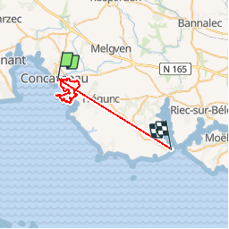
![](/images/other/stat-length.png)
![Tour Wandern Concarneau - Concarneau - Photo](https://media.geolcdn.com/t/1900/400/ext.pjpeg?maxdim=2&url=https%3A%2F%2Fmedia.geolcdn.com%2Ff%2Fc8e14188-59e6-45fc-97a1-567ba3c5a7c1.jpg)
Concarneau
janussity
Benutzer
![Länge](/images/other/stat-length.png)
Länge
32 km
![Maximale Höhe](https://static1.geolcdn.com/siteimages/upload/files/1508320355ic_sort_altitude_max_24dp.png)
Maximale Höhe
45 m
![Positive Höhendifferenz](https://static1.geolcdn.com/siteimages/upload/files/1508320355ic_sort_den_pos_24dp.png)
Positive Höhendifferenz
286 m
![Km-Effort](/images/other/stat-length.png)
Km-Effort
36 km
![Min. Höhe](https://static1.geolcdn.com/siteimages/upload/files/1508320355ic_sort_altitude_min_24dp.png)
Min. Höhe
-3 m
![Negative Höhendifferenz](https://static1.geolcdn.com/siteimages/upload/files/1508320355ic_sort_den_neg_24dp.png)
Negative Höhendifferenz
267 m
![Boucle](https://static1.geolcdn.com/siteimages/upload/files/16400158638029165_repeat_loop_refresh_sync_direction_icon.png)
Boucle
Nein
Erstellungsdatum :
2019-06-17 07:38:54.526
Letzte Änderung :
2019-06-17 17:23:27.085
![Wandern](https://static1.geolcdn.com/sitytour/trail-icons/101.png)
7h08
Schwierigkeit : Medium
![Scannen Sie diesen QR-Code, um die Tour in der SityTrail-Anwendung zu öffnen](https://capi.geolives.com/qq0zvz2zws4bq2lad0pu/sitytour/trails/2116819/qr.png?size=200)
Kostenlosegpshiking-Anwendung
Über SityTrail
Tour Wandern von 32 km verfügbar auf Bretagne, Finistère, Concarneau. Diese Tour wird von janussity vorgeschlagen.
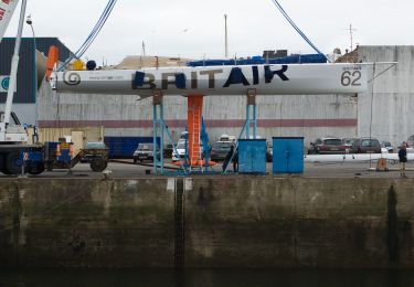
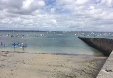
Beschreibung
Beau temps
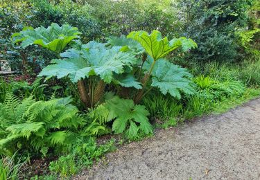
traversée de lotissement
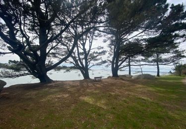
un peu de sentier cotier
Ort
Land:
France
Region :
Bretagne
Abteilung/Provinz :
Finistère
Kommune :
Concarneau
Standort:
Unknown
Gehen Sie:(Dec)
Gehen Sie:(UTM)
431465 ; 5302433 (30T) N.
Kommentare
Touren in der Umgebung
![Tour Laufen Trégunc - GR34 - 31 - Photo](https://media.geolcdn.com/t/375/260/ext.jpg?maxdim=2&url=https%3A%2F%2Fstatic1.geolcdn.com%2Fsiteimages%2Fupload%2Ffiles%2F1524743154running.jpg)
![Laufen Laufen](https://static1.geolcdn.com/sitytour/trail-icons/103.png)
![Tour Wandern Concarneau - Concarneau - Photo](https://media.geolcdn.com/t/375/260/ext.jpg?maxdim=2&url=https%3A%2F%2Fmedia.geolcdn.com%2Ff%2F2444e120-f150-4c71-a608-b49e9d318714.jpg)
![Wandern Wandern](https://static1.geolcdn.com/sitytour/trail-icons/101.png)
![Tour Laufen Fouesnant - Des dunes à la mer blanche - Photo](https://media.geolcdn.com/t/375/260/ext.jpg?maxdim=2&url=https%3A%2F%2Fmedia.geolcdn.com%2Ff%2F7fdce5c7-5ee5-431b-bdc0-c7bba51fc745.jpg)
![Laufen Laufen](https://static1.geolcdn.com/sitytour/trail-icons/103.png)
Des dunes à la mer blanche
Laufen
Sehr leicht
Fouesnant,
Bretagne,
Finistère,
France
![](/images/other/stat-length.png)
18,8 km | 19,8 km-effort
2h 18min
![](https://static1.geolcdn.com/siteimages/upload/files/16400158638029165_repeat_loop_refresh_sync_direction_icon.png)
Ja
![Tour Wandern Trégunc - Tregunc - Photo](https://media.geolcdn.com/t/375/260/ext.jpg?maxdim=2&url=https%3A%2F%2Fmedia.geolcdn.com%2Ff%2F0294ed77-693d-4112-8e2e-97085a77d8cd.jpg)
![Wandern Wandern](https://static1.geolcdn.com/sitytour/trail-icons/101.png)
![Tour Zu Fuß Concarneau - Sentier Côtier du Moros - Photo](https://media.geolcdn.com/t/375/260/ext.jpg?maxdim=2&url=https%3A%2F%2Fmedia.geolcdn.com%2Ff%2F370a1ef6-acb4-40b8-b86a-15fe25cfb993.jpeg)
![Zu Fuß Zu Fuß](https://static1.geolcdn.com/sitytour/trail-icons/100.png)
Sentier Côtier du Moros
Zu Fuß
Einfach
Concarneau,
Bretagne,
Finistère,
France
![](/images/other/stat-length.png)
5 km | 6,1 km-effort
1h 22min
![](https://static1.geolcdn.com/siteimages/upload/files/16400158638029165_repeat_loop_refresh_sync_direction_icon.png)
Ja
![Tour Wandern Concarneau - Beg Meil kerambigorn -Concarneau - Photo](https://media.geolcdn.com/t/375/260/ext.jpg?maxdim=2&url=https%3A%2F%2Fservices.sitytrail.com%2FGeolivesWS%2FDownloadMedia.ashx%3FTrailID%3D797152%26Media%3D20170727154145.jpg)
![Wandern Wandern](https://static1.geolcdn.com/sitytour/trail-icons/101.png)
Beg Meil kerambigorn -Concarneau
Wandern
Einfach
Concarneau,
Bretagne,
Finistère,
France
![](/images/other/stat-length.png)
23 km | 26 km-effort
4h 49min
![](https://static1.geolcdn.com/siteimages/upload/files/16400158638029165_repeat_loop_refresh_sync_direction_icon.png)
Nein
![Tour Wandern Concarneau - 29-1-Concarneau Est - Photo](https://media.geolcdn.com/t/375/260/ext.jpg?maxdim=2&url=https%3A%2F%2Fstatic1.geolcdn.com%2Fsiteimages%2Fupload%2Ffiles%2F1553511878bg_sport_marche.png)
![Wandern Wandern](https://static1.geolcdn.com/sitytour/trail-icons/101.png)
29-1-Concarneau Est
Wandern
Einfach
(1)
Concarneau,
Bretagne,
Finistère,
France
![](/images/other/stat-length.png)
12,4 km | 13,7 km-effort
3h 30min
![](https://static1.geolcdn.com/siteimages/upload/files/16400158638029165_repeat_loop_refresh_sync_direction_icon.png)
Ja
![Tour Wandern Fouesnant - Balade autour de la zone naturelle - Photo](https://media.geolcdn.com/t/375/260/ext.jpg?maxdim=2&url=https%3A%2F%2Fstatic1.geolcdn.com%2Fsiteimages%2Fupload%2Ffiles%2F1553511878bg_sport_marche.png)
![Wandern Wandern](https://static1.geolcdn.com/sitytour/trail-icons/101.png)
Balade autour de la zone naturelle
Wandern
Medium
(1)
Fouesnant,
Bretagne,
Finistère,
France
![](/images/other/stat-length.png)
12,3 km | 12,9 km-effort
2h 55min
![](https://static1.geolcdn.com/siteimages/upload/files/16400158638029165_repeat_loop_refresh_sync_direction_icon.png)
Ja
![Tour Wandern Fouesnant - baie autour de cap coz vers fouebant Penfoulick - Photo](https://media.geolcdn.com/t/375/260/ext.jpg?maxdim=2&url=https%3A%2F%2Fmedia.geolcdn.com%2Ff%2F36d7fa5f-f3d2-42ab-8c5a-5f51ef0fb088.jpg)
![Wandern Wandern](https://static1.geolcdn.com/sitytour/trail-icons/101.png)
baie autour de cap coz vers fouebant Penfoulick
Wandern
Medium
Fouesnant,
Bretagne,
Finistère,
France
![](/images/other/stat-length.png)
5,6 km | 6,5 km-effort
1h 31min
![](https://static1.geolcdn.com/siteimages/upload/files/16400158638029165_repeat_loop_refresh_sync_direction_icon.png)
Nein