Tour Mountainbike Rodez - Rodez Agglomeration - Circuit 5 - Les abeilles  - Photo

Rodez Agglomeration - Circuit 5 - Les abeilles

 randoruthene
randoruthene

Benutzer

© OpenStreetMap contributors
Länge
Länge
14,6 km
Maximale Höhe
Maximale Höhe
614 m
Positive Höhendifferenz
330 m
Km-Effort
Km-Effort  
19 km
Min. Höhe
Min. Höhe
506 m
Negative Höhendifferenz
330 m
Boucle
Boucle
Ja
Erstellungsdatum :
2020-07-27 09:49:12.123
Letzte Änderung :
2020-07-27 09:50:02.82

(0 Nachricht)

Mountainbike
Mountainbike
1h14
Schwierigkeit : Einfach

Scannen Sie diesen QR-Code, um die Tour in der SityTrail-Anwendung zu öffnen

Kostenlosegpshiking-Anwendung

Logo SityTrail SityTrail

IGN / Geografische Institute

SityTrail aus dem App Store herunterladen SityTrail von Google Play herunterladen

Logo SityTrail SityTrail World

Die Welt öffnet sich für Sie

SityTrail aus dem App Store herunterladen SityTrail von Google Play herunterladen SityTrail auf Huawei AppGallery herunterladen

Über SityTrail

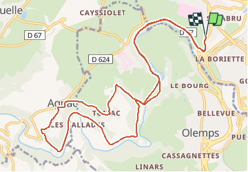
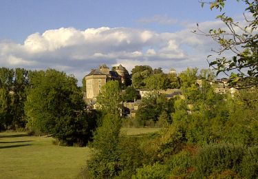
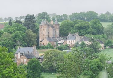
Tour Mountainbike von 14,6 km verfügbar auf Okzitanien, Aveyron, Rodez. Diese Tour wird von randoruthene vorgeschlagen.

Beschreibung

Espace VTT Rodez Agglo - 400 km de chemins balisés - 18 circuits labéllisés FFC
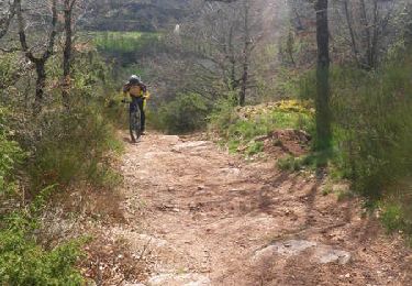
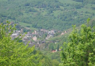
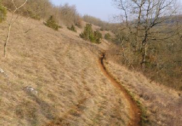
Il s’agit d’un circuit vert, facile, qui vous offrira de jolis points de vue et vous permettra de traverser de beaux villages aux portes de Rodez. Vous pourrez également découvrir la verdoyante vallée de l’Aveyron. Une seule portion de descente (fin de descente après Agnac) présente quelques courts passages qui pourront demander aux débutants de mettre pied à terre, mais elle peut être contournée par la route.

Höhenprofil

Foto-Galerie

Ort

Land:
France
Region :
Okzitanien
Abteilung/Provinz :
Aveyron
Kommune :
Rodez
Standort:
Unknown
Gehen Sie:(UTM)
464577 ; 4911518 (31T) N.

Touren in der Umgebung

Tour Mountainbike Druelle Balsac - Autour de l'Aveyron de Agnac à Ampiac - Photo
Mountainbike
tracegps

Mountainbike

Sehr schwierig
(1)
Druelle Balsac, Okzitanien, Aveyron, France
15,7 km | 24 km-effort
3h 45min
Ja
Tour Mountainbike Onet-le-Château - Randonnée VTT boucle d'Onet le Château à Macillac - Photo
Mountainbike
tracegps

Mountainbike

Schwierig
(1)
Onet-le-Château, Okzitanien, Aveyron, France
39 km | 51 km-effort
5h 40min
Ja
Tour Mountainbike Onet-le-Château - Onet - Mondalazac - Onet - Photo
Mountainbike
tracegps

Mountainbike

Schwierig
(2)
Onet-le-Château, Okzitanien, Aveyron, France
45 km | 52 km-effort
4h 0min
Nein
Tour Zu Fuß Rodez - Randonnée de Rodez Agglomération Circuit n°2 - Layoule - Photo
Zu Fuß
PRO

Zu Fuß

Einfach
Rodez, Okzitanien, Aveyron, France
5,6 km | 6,6 km-effort
1h 29min
Ja
Tour Zu Fuß Onet-le-Château - Circuit 20 Vabres - Photo
Zu Fuß
PRO

Zu Fuß

Einfach
Onet-le-Château, Okzitanien, Aveyron, France
4,9 km | 5,8 km-effort
1h 18min
Ja
Tour Zu Fuß Onet-le-Château - Circuit 16 Moulin de cantarane - Photo
Zu Fuß
PRO

Zu Fuß

Einfach
Onet-le-Château, Okzitanien, Aveyron, France
6,3 km | 8 km-effort
1h 48min
Ja
Tour Zu Fuß Le Monastère - Circuit 11 Le Monsastère - Photo
Zu Fuß
PRO

Zu Fuß

Einfach
Le Monastère, Okzitanien, Aveyron, France
6,4 km | 7,9 km-effort
1h 47min
Nein
Tour Zu Fuß Luc-la-Primaube - Circuit 9 Planèzes - Photo
Zu Fuß
PRO

Zu Fuß

Einfach
Luc-la-Primaube, Okzitanien, Aveyron, France
8,8 km | 11,5 km-effort
2h 37min
Ja
Tour Zu Fuß Olemps - Circuit 8 Le Viel Olemps - Photo
Zu Fuß
PRO

Zu Fuß

Einfach
Olemps, Okzitanien, Aveyron, France
5,1 km | 6,5 km-effort
1h 29min
Ja


Schließen
Meine Abonnements