


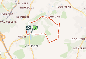


5,7 km | 6,7 km-effort

Benutzer


Kostenlosegpshiking-Anwendung
 SityTrail
IGN / Geografische Institute
SityTrail World
Die Welt öffnet sich für Sie
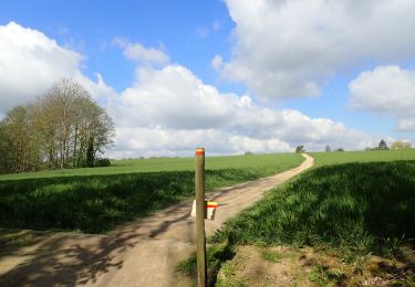
Tour Wandern von 5,6 km verfügbar auf Wallonien, Wallonisch-Brabant, Chaumont-Gistoux. Diese Tour wird von MicDul vorgeschlagen.
Le départ est situé au lieudit "La Place", là où vous trouverez où vous garer, non loin de l'entrée du Château de Vieusart.


Wandern

Wandern

Wandern
Wandern

Wandern
Wandern

Wandern
Wandern
Wandern