


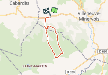

18,2 km | 26 km-effort


Benutzer


Kostenlosegpshiking-Anwendung
 SityTrail
IGN / Geografische Institute
SityTrail World
Die Welt öffnet sich für Sie
Tour Wandern von 5,4 km verfügbar auf Okzitanien, Aude, Villeneuve-Minervois. Diese Tour wird von cappelle vorgeschlagen.
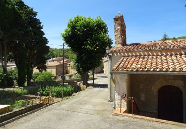
petite boucle sympa sans difficulté au départ de la chapelle de Saint Mames avec belle vue sur la chaîne des Pyrénées


Wandern
Mountainbike
Zu Fuß

Wandern
Wandern
Wandern

Wandern