


15,4 km | 27 km-effort


Benutzer


Kostenlosegpshiking-Anwendung
 SityTrail
IGN / Geografische Institute
SityTrail World
Die Welt öffnet sich für Sie
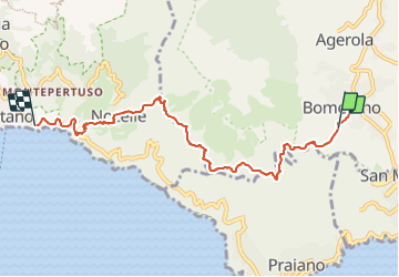
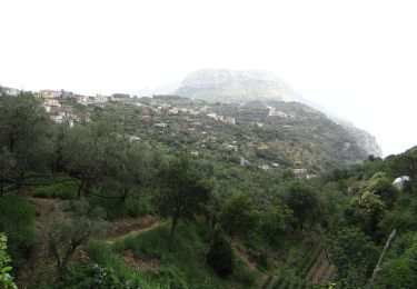
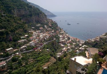
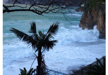
Tour Wandern von 8,4 km verfügbar auf Kampanien, Metropolitanstadt Neapel, Agerola. Diese Tour wird von ericberlin vorgeschlagen.
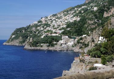
Une merveille ce Sentier des Dieux appelé Sentiero Degli Dei ou Path of Gods
2h de Bomerano à Nocelle, suivre les balises CAI327 ou marquage rouge et blanc.
1h de Nocelle à Positano (CAI331) avec 2 variantes :
a) descente de Nocelle à Arienzo par les marches (1600 ). marquage rouge et blanc direction sud.
b) descente de Nocelle à Positano par la corniche de Montepertuzo -en partie par la route Vito Talamo-. marquage rouge et blanc direction nord
Accès au départ en bus, ligne depuis Amalfi vers Agerola, stop à Bomerola
(privilégier le départ du bus à 7h10 depuis Amalfi, moins de monde, belle lumière et fraicheur)
- Epicerie, bar et magasin d'articles de rando à Bomerola.
- Epicerie-bar sympa à Nocelle.
- Arrêt de bus et plage à Arienzo
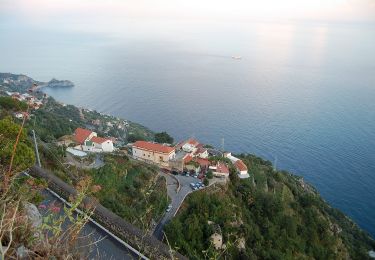
- Plage, restos à Positano, bus ou ferry pour retour à Amalfi.
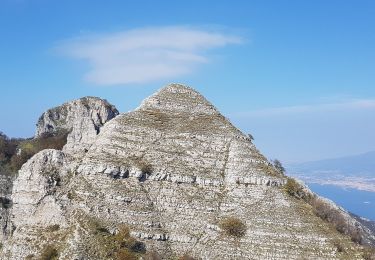
Sentier en corniche plein sud avec peu d'ombre. Prévoir de bonnes chaussures -pierres glissantes-, eau, chapeau, carte -certaines bifurcations restent ambigües-
Eviter les journées chaudes ou sans visibilité -ce serait si dommage de le faire avec de la brume-.
Carte topo et remerciements au Club Alpin Italien: https://www.caimontilattari.it/en/sentiero/327/
https://www.caimontilattari.it/en/sentiero/331/
Bus:
https://www.sitasudtrasporti.it/orari
Un sentier qui mérite son nom et sa réputation.
Commentaires bienvenus, merci.
____________
The Path Of Gods (Sentiero Degli Dei) is a must for hikkers!
2 hours from Bomerano to Nocelle Follow the red and white marks or CAI327.
1 hour from Nocelle to Positano with 2 variants:
a) descent from Nocelle to Arienzo across the steps (1600 ).
Red and white marks, South direction (CAI331 path)
b) descent from Nocelle to Positano via the Montepertuzo ledge -partly with Vito Talamo road-.
Red and white marks, North direction (CAI331 path)
Access to departure by bus from Amalfi to Agerola, stop in Bomerola.
(prefer the departure of the bus at 7:10 am from Amalfi, less people, morning light, fresher temperature)
- Grocery store, bar and hiking gear store in Bomerola.
- Grocery-bar in Nocelle.
- Bus stop and beach in Arienzo
- Beach, many restaurants in Positano, bus or ferry for return to Amalfi.
South facing ledge trail with few shade.
Bring good shoes -slippery stones-, water, hat, map -some junctions are still poorly marked-
Avoid hot days or days with mist.
Maps and credit to CAI: https://www.caimontilattari.it/en/sentiero/327/
https://www.caimontilattari.it/en/sentiero/331/
Bus:
https://www.sitasudtrasporti.it/orari
Enjoy! Comment appreciated thank you.


Zu Fuß

Zu Fuß
Zu Fuß
Zu Fuß
Zu Fuß
Zu Fuß
Zu Fuß
Zu Fuß