![](/images/other/stat-length.png)
![Tour Wandern Bois-le-Roi - 2023-06-28_21h36m36_de-bois-le-roi-a-fontainebleau - Photo](https://media.geolcdn.com/t/1900/400/ext.pjpeg?maxdim=2&url=https%3A%2F%2Fstatic1.geolcdn.com%2Fsiteimages%2Fupload%2Ffiles%2F1553511878bg_sport_marche.png)
2023-06-28_21h36m36_de-bois-le-roi-a-fontainebleau
jpcccb
Benutzer
![Länge](/images/other/stat-length.png)
Länge
16,5 km
![Maximale Höhe](https://static1.geolcdn.com/siteimages/upload/files/1508320355ic_sort_altitude_max_24dp.png)
Maximale Höhe
153 m
![Positive Höhendifferenz](https://static1.geolcdn.com/siteimages/upload/files/1508320355ic_sort_den_pos_24dp.png)
Positive Höhendifferenz
255 m
![Km-Effort](/images/other/stat-length.png)
Km-Effort
19,9 km
![Min. Höhe](https://static1.geolcdn.com/siteimages/upload/files/1508320355ic_sort_altitude_min_24dp.png)
Min. Höhe
78 m
![Negative Höhendifferenz](https://static1.geolcdn.com/siteimages/upload/files/1508320355ic_sort_den_neg_24dp.png)
Negative Höhendifferenz
255 m
![Boucle](https://static1.geolcdn.com/siteimages/upload/files/16400158638029165_repeat_loop_refresh_sync_direction_icon.png)
Boucle
Nein
Erstellungsdatum :
2023-06-28 19:36:36.855
Letzte Änderung :
2023-07-05 09:48:04.235
![Wandern](https://static1.geolcdn.com/sitytour/trail-icons/101.png)
4h31
Schwierigkeit : Sehr schwierig
![Scannen Sie diesen QR-Code, um die Tour in der SityTrail-Anwendung zu öffnen](https://capi.geolives.com/qq0zvz2zws4bq2lad0pu/sitytour/trails/3716132/qr.png?size=200)
Kostenlosegpshiking-Anwendung
Über SityTrail
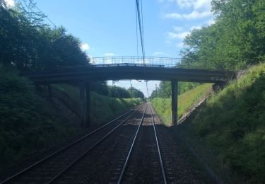
Tour Wandern von 16,5 km verfügbar auf Île-de-France, Seine-et-Marne, Bois-le-Roi. Diese Tour wird von jpcccb vorgeschlagen.
Beschreibung
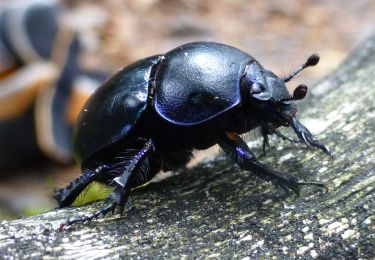
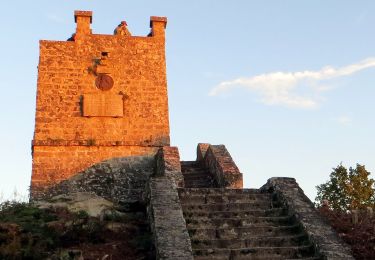
GR 1 TMF, GR 1 E, carrefour des longues vallées, grotte aux cristaux, route des hauteurs de la Solle, route du nid d'aigle, caverne d'Augas.
Ort
Land:
France
Region :
Île-de-France
Abteilung/Provinz :
Seine-et-Marne
Kommune :
Bois-le-Roi
Standort:
Unknown
Gehen Sie:(Dec)
Gehen Sie:(UTM)
477241 ; 5369187 (31U) N.
Kommentare
Touren in der Umgebung
![Tour Wandern Bois-le-Roi - 170822 - RECO BoisLeRoi-Cmcas - Photo](https://media.geolcdn.com/t/375/260/ext.jpg?maxdim=2&url=https%3A%2F%2Fservices.sitytrail.com%2FGeolivesWS%2FDownloadMedia.ashx%3FTrailID%3D815573%26Media%3Dfix__20170822110103.jpg)
![Wandern Wandern](https://static1.geolcdn.com/sitytour/trail-icons/101.png)
170822 - RECO BoisLeRoi-Cmcas
Wandern
Sehr leicht
(1)
Bois-le-Roi,
Île-de-France,
Seine-et-Marne,
France
![](/images/other/stat-length.png)
8,7 km | 10 km-effort
2h 41min
![](https://static1.geolcdn.com/siteimages/upload/files/16400158638029165_repeat_loop_refresh_sync_direction_icon.png)
Ja
![Tour Wandern Fontainebleau - 131204-GLM - CxToulouse-StLouis - Photo](https://media.geolcdn.com/t/375/260/ext.jpg?maxdim=2&url=https%3A%2F%2Fservices.sitytrail.com%2FGeolivesWS%2FDownloadMedia.ashx%3FTrailID%3D235773%26Media%3Df4996202-b0e3-463d-bbc3-f9ae550a1c06.jpg)
![Wandern Wandern](https://static1.geolcdn.com/sitytour/trail-icons/101.png)
131204-GLM - CxToulouse-StLouis
Wandern
Einfach
(3)
Fontainebleau,
Île-de-France,
Seine-et-Marne,
France
![](/images/other/stat-length.png)
9 km | 10,7 km-effort
3h 0min
![](https://static1.geolcdn.com/siteimages/upload/files/16400158638029165_repeat_loop_refresh_sync_direction_icon.png)
Ja
![Tour Zu Fuß Fontainebleau - Sentier Denecourt-Colinet 6 - Photo](https://media.geolcdn.com/t/375/260/ext.jpg?maxdim=2&url=https%3A%2F%2Fmedia.geolcdn.com%2Ff%2F84fa17bd-598b-4ebd-b9b0-c63398cc2d74.jpeg)
![Zu Fuß Zu Fuß](https://static1.geolcdn.com/sitytour/trail-icons/100.png)
Sentier Denecourt-Colinet 6
Zu Fuß
Einfach
(1)
Fontainebleau,
Île-de-France,
Seine-et-Marne,
France
![](/images/other/stat-length.png)
4,4 km | 5,5 km-effort
1h 15min
![](https://static1.geolcdn.com/siteimages/upload/files/16400158638029165_repeat_loop_refresh_sync_direction_icon.png)
Nein
![Tour Zu Fuß Fontainebleau - Sentier Denecourt-Colinet 12 - Photo](https://media.geolcdn.com/t/375/260/ext.jpg?maxdim=2&url=https%3A%2F%2Fmedia.geolcdn.com%2Ff%2F4814649c-af40-4388-baba-539eb58b1bea.jpeg)
![Zu Fuß Zu Fuß](https://static1.geolcdn.com/sitytour/trail-icons/100.png)
Sentier Denecourt-Colinet 12
Zu Fuß
Einfach
(1)
Fontainebleau,
Île-de-France,
Seine-et-Marne,
France
![](/images/other/stat-length.png)
8 km | 9,2 km-effort
2h 5min
![](https://static1.geolcdn.com/siteimages/upload/files/16400158638029165_repeat_loop_refresh_sync_direction_icon.png)
Nein
![Tour Zu Fuß Fontainebleau - Sentier Denecourt-Colinet 14 - Photo](https://media.geolcdn.com/t/375/260/ext.jpg?maxdim=2&url=https%3A%2F%2Fmedia.geolcdn.com%2Ff%2Fe3b26b6d-341e-4bfd-a76b-6d3ea26f2bf8.jpeg)
![Zu Fuß Zu Fuß](https://static1.geolcdn.com/sitytour/trail-icons/100.png)
Sentier Denecourt-Colinet 14
Zu Fuß
Einfach
Fontainebleau,
Île-de-France,
Seine-et-Marne,
France
![](/images/other/stat-length.png)
5,3 km | 6,5 km-effort
1h 28min
![](https://static1.geolcdn.com/siteimages/upload/files/16400158638029165_repeat_loop_refresh_sync_direction_icon.png)
Nein
![Tour Zu Fuß Samois-sur-Seine - Sentier Denecourt-Colinet 15 - Photo](https://media.geolcdn.com/t/375/260/ext.jpg?maxdim=2&url=https%3A%2F%2Fmedia.geolcdn.com%2Ff%2F0f6a8269-d3a9-4e13-9f62-8166bdbbe4ed.jpeg)
![Zu Fuß Zu Fuß](https://static1.geolcdn.com/sitytour/trail-icons/100.png)
Sentier Denecourt-Colinet 15
Zu Fuß
Einfach
Samois-sur-Seine,
Île-de-France,
Seine-et-Marne,
France
![](/images/other/stat-length.png)
7,8 km | 8,9 km-effort
2h 1min
![](https://static1.geolcdn.com/siteimages/upload/files/16400158638029165_repeat_loop_refresh_sync_direction_icon.png)
Nein
![Tour Wandern Fontainebleau - F Belle-Croix 4-15-4 R St-Germain puis Mts Butte St-Louis - Photo](https://media.geolcdn.com/t/375/260/ext.jpg?maxdim=2&url=https%3A%2F%2Fstatic1.geolcdn.com%2Fsiteimages%2Fupload%2Ffiles%2F1553511878bg_sport_marche.png)
![Wandern Wandern](https://static1.geolcdn.com/sitytour/trail-icons/101.png)
F Belle-Croix 4-15-4 R St-Germain puis Mts Butte St-Louis
Wandern
Medium
(1)
Fontainebleau,
Île-de-France,
Seine-et-Marne,
France
![](/images/other/stat-length.png)
9,2 km | 11,3 km-effort
2h 21min
![](https://static1.geolcdn.com/siteimages/upload/files/16400158638029165_repeat_loop_refresh_sync_direction_icon.png)
Ja
![Tour Wandern Fontainebleau - Le Rocher Saint-Germain et la Tour de Samois - Photo](https://media.geolcdn.com/t/375/260/ext.jpg?maxdim=2&url=https%3A%2F%2Fstatic1.geolcdn.com%2Fsiteimages%2Fupload%2Ffiles%2F1553511878bg_sport_marche.png)
![Wandern Wandern](https://static1.geolcdn.com/sitytour/trail-icons/101.png)
Le Rocher Saint-Germain et la Tour de Samois
Wandern
Schwierig
(1)
Fontainebleau,
Île-de-France,
Seine-et-Marne,
France
![](/images/other/stat-length.png)
21 km | 25 km-effort
5h 50min
![](https://static1.geolcdn.com/siteimages/upload/files/16400158638029165_repeat_loop_refresh_sync_direction_icon.png)
Ja
![Tour Nordic Walking Bois-le-Roi - marche Fontainebleau - Photo](https://media.geolcdn.com/t/375/260/ext.jpg?maxdim=2&url=https%3A%2F%2Fstatic1.geolcdn.com%2Fsiteimages%2Fupload%2Ffiles%2F1545311037marcheuse_200dpi.jpg)
![Nordic Walking Nordic Walking](https://static1.geolcdn.com/sitytour/trail-icons/102.png)
marche Fontainebleau
Nordic Walking
Einfach
(1)
Bois-le-Roi,
Île-de-France,
Seine-et-Marne,
France
![](/images/other/stat-length.png)
25 km | 29 km-effort
5h 44min
![](https://static1.geolcdn.com/siteimages/upload/files/16400158638029165_repeat_loop_refresh_sync_direction_icon.png)
Ja