![](/images/other/stat-length.png)
![Tour Mountainbike Badenweiler - rando des lacs 2016 - Photo](https://media.geolcdn.com/t/1900/400/ext.pjpeg?maxdim=2&url=https%3A%2F%2Fservices.sitytrail.com%2FGeolivesWS%2FDownloadMedia.ashx%3FTrailID%3D579807%26Media%3Dfix__20160605092745.jpg)
rando des lacs 2016
fabwin
Benutzer GUIDE
![Länge](/images/other/stat-length.png)
Länge
32 km
![Maximale Höhe](https://static1.geolcdn.com/siteimages/upload/files/1508320355ic_sort_altitude_max_24dp.png)
Maximale Höhe
521 m
![Positive Höhendifferenz](https://static1.geolcdn.com/siteimages/upload/files/1508320355ic_sort_den_pos_24dp.png)
Positive Höhendifferenz
746 m
![Km-Effort](/images/other/stat-length.png)
Km-Effort
42 km
![Min. Höhe](https://static1.geolcdn.com/siteimages/upload/files/1508320355ic_sort_altitude_min_24dp.png)
Min. Höhe
311 m
![Negative Höhendifferenz](https://static1.geolcdn.com/siteimages/upload/files/1508320355ic_sort_den_neg_24dp.png)
Negative Höhendifferenz
747 m
![Boucle](https://static1.geolcdn.com/siteimages/upload/files/16400158638029165_repeat_loop_refresh_sync_direction_icon.png)
Boucle
Ja
Erstellungsdatum :
2016-06-05 00:00:00.0
Letzte Änderung :
2016-06-05 00:00:00.0
![Mountainbike](https://static1.geolcdn.com/sitytour/trail-icons/202.png)
2h45
Schwierigkeit : Schwierig
![Scannen Sie diesen QR-Code, um die Tour in der SityTrail-Anwendung zu öffnen](https://capi.geolives.com/qq0zvz2zws4bq2lad0pu/sitytour/trails/579807/qr.png?size=200)
Kostenlosegpshiking-Anwendung
Über SityTrail
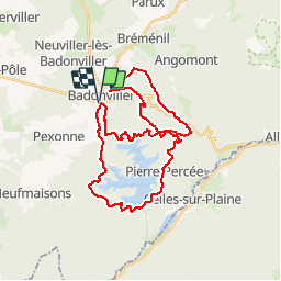
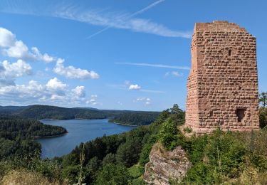
Tour Mountainbike von 32 km verfügbar auf Großer Osten, Mörthe und Mosel, Badenweiler. Diese Tour wird von fabwin vorgeschlagen.
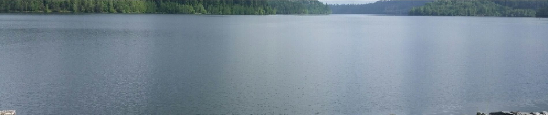
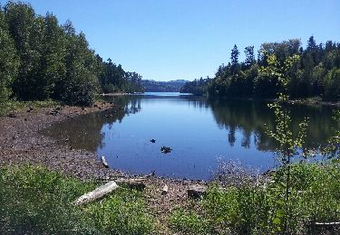
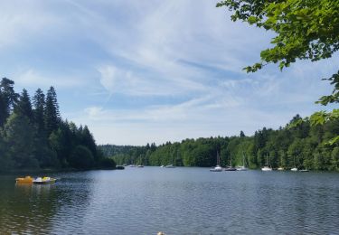
Beschreibung
Avec Séb et Maxime.
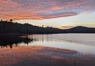
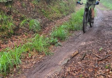
Beaucoup de boue mais un super temps aujourd'hui. On s'est régalé mais par contre fatigué!!!!
Ort
Land:
France
Region :
Großer Osten
Abteilung/Provinz :
Mörthe und Mosel
Kommune :
Badenweiler
Standort:
Unknown
Gehen Sie:(Dec)
Gehen Sie:(UTM)
344290 ; 5373669 (32U) N.
Kommentare
Touren in der Umgebung
![Tour Wandern Langstein - Tour du lac du Vieux-Pré - Photo](https://media.geolcdn.com/t/375/260/ext.jpg?maxdim=2&url=https%3A%2F%2Fservices.sitytrail.com%2FGeolivesWS%2FDownloadMedia.ashx%3FTrailID%3D148084%26Media%3D132fd7f5-5497-4b6c-92cf-7a8c31304801.jpeg)
![Wandern Wandern](https://static1.geolcdn.com/sitytour/trail-icons/101.png)
Tour du lac du Vieux-Pré
Wandern
Schwierig
(2)
Langstein,
Großer Osten,
Mörthe und Mosel,
France
![](/images/other/stat-length.png)
30 km | 38 km-effort
8h 35min
![](https://static1.geolcdn.com/siteimages/upload/files/16400158638029165_repeat_loop_refresh_sync_direction_icon.png)
Ja
![Tour Wandern Langstein - pierre percée, circuit des roches, etc... - Photo](https://media.geolcdn.com/t/375/260/ext.jpg?maxdim=2&url=https%3A%2F%2Fservices.sitytrail.com%2FGeolivesWS%2FDownloadMedia.ashx%3FTrailID%3D414922%26Media%3Dfix__20150409180402.jpg)
![Wandern Wandern](https://static1.geolcdn.com/sitytour/trail-icons/101.png)
pierre percée, circuit des roches, etc...
Wandern
Medium
(2)
Langstein,
Großer Osten,
Mörthe und Mosel,
France
![](/images/other/stat-length.png)
20 km | 28 km-effort
8h 0min
![](https://static1.geolcdn.com/siteimages/upload/files/16400158638029165_repeat_loop_refresh_sync_direction_icon.png)
Ja
![Tour Wandern Pexonne - 2023-07-23 Marche Bivouac Lac de la pierre percee - Photo](https://media.geolcdn.com/t/375/260/ext.jpg?maxdim=2&url=https%3A%2F%2Fmedia.geolcdn.com%2Ff%2Fcd9470f2-fe5f-4ab0-9ba0-68d66ffbfb13.jpg)
![Wandern Wandern](https://static1.geolcdn.com/sitytour/trail-icons/101.png)
2023-07-23 Marche Bivouac Lac de la pierre percee
Wandern
Einfach
Pexonne,
Großer Osten,
Mörthe und Mosel,
France
![](/images/other/stat-length.png)
12,8 km | 16,1 km-effort
3h 11min
![](https://static1.geolcdn.com/siteimages/upload/files/16400158638029165_repeat_loop_refresh_sync_direction_icon.png)
Nein
![Tour Wandern Badenweiler - 2023-07-22 Marche Bivouac Lac de la pierre percee - Photo](https://media.geolcdn.com/t/375/260/ext.jpg?maxdim=2&url=https%3A%2F%2Fmedia.geolcdn.com%2Ff%2F122d3872-bd00-4b8d-bfcc-b1533062f5e9.jpg)
![Wandern Wandern](https://static1.geolcdn.com/sitytour/trail-icons/101.png)
2023-07-22 Marche Bivouac Lac de la pierre percee
Wandern
Einfach
Badenweiler,
Großer Osten,
Mörthe und Mosel,
France
![](/images/other/stat-length.png)
21 km | 27 km-effort
6h 35min
![](https://static1.geolcdn.com/siteimages/upload/files/16400158638029165_repeat_loop_refresh_sync_direction_icon.png)
Nein
![Tour Reiten Badenweiler - Lac de Pierre Percée 25 km - Photo](https://media.geolcdn.com/t/375/260/ext.jpg?maxdim=2&url=https%3A%2F%2Fstatic1.geolcdn.com%2Fsiteimages%2Fupload%2Ffiles%2F1524743154cheval.jpg)
![Reiten Reiten](https://static1.geolcdn.com/sitytour/trail-icons/301.png)
Lac de Pierre Percée 25 km
Reiten
Schwierig
(1)
Badenweiler,
Großer Osten,
Mörthe und Mosel,
France
![](/images/other/stat-length.png)
25 km | 32 km-effort
4h 13min
![](https://static1.geolcdn.com/siteimages/upload/files/16400158638029165_repeat_loop_refresh_sync_direction_icon.png)
Ja
![Tour Mountainbike Badenweiler - sortie vtt du 03062018 rando pierre percée - Photo](https://media.geolcdn.com/t/375/260/ext.jpg?maxdim=2&url=https%3A%2F%2Fmedia.geolcdn.com%2Ff%2Fdedf4087-0ad3-4005-8656-d44010bac430.jpg)
![Mountainbike Mountainbike](https://static1.geolcdn.com/sitytour/trail-icons/202.png)
sortie vtt du 03062018 rando pierre percée
Mountainbike
Medium
Badenweiler,
Großer Osten,
Mörthe und Mosel,
France
![](/images/other/stat-length.png)
45 km | 57 km-effort
2h 30min
![](https://static1.geolcdn.com/siteimages/upload/files/16400158638029165_repeat_loop_refresh_sync_direction_icon.png)
Ja
![Tour Elektrofahrrad Badenweiler - rando des lacs 2024 - Photo](https://media.geolcdn.com/t/375/260/ext.jpg?maxdim=2&url=https%3A%2F%2Fmedia.geolcdn.com%2Ff%2Fc11769f2-60a9-4875-a433-155ba7c6a4c7.jpg)
![Elektrofahrrad Elektrofahrrad](https://static1.geolcdn.com/sitytour/trail-icons/205.png)
rando des lacs 2024
Elektrofahrrad
Schwierig
Badenweiler,
Großer Osten,
Mörthe und Mosel,
France
![](/images/other/stat-length.png)
35 km | 46 km-effort
3h 40min
![](https://static1.geolcdn.com/siteimages/upload/files/16400158638029165_repeat_loop_refresh_sync_direction_icon.png)
Ja
![Tour Pfad Angomont - thiaville, les hauts faîte planches vala des fous - Photo](https://media.geolcdn.com/t/375/260/ext.jpg?maxdim=2&url=https%3A%2F%2Fstatic1.geolcdn.com%2Fsiteimages%2Fupload%2Ffiles%2F1524743154running.jpg)
![Pfad Pfad](https://static1.geolcdn.com/sitytour/trail-icons/104.png)
thiaville, les hauts faîte planches vala des fous
Pfad
Einfach
(1)
Angomont,
Großer Osten,
Mörthe und Mosel,
France
![](/images/other/stat-length.png)
12,9 km | 16,9 km-effort
Unbekannt
![](https://static1.geolcdn.com/siteimages/upload/files/16400158638029165_repeat_loop_refresh_sync_direction_icon.png)
Ja
![Tour Radtourismus Badenweiler - Via Pax étape 2 - Manonviller / Bures - Photo](https://media.geolcdn.com/t/375/260/ext.jpg?maxdim=2&url=https%3A%2F%2Fmedia.geolcdn.com%2Ff%2F03cbbc3d-65ef-4acb-a4e8-6956ed65c7ac.png)
![Radtourismus Radtourismus](https://static1.geolcdn.com/sitytour/trail-icons/204.png)
Via Pax étape 2 - Manonviller / Bures
Radtourismus
Medium
Badenweiler,
Großer Osten,
Mörthe und Mosel,
France
![](/images/other/stat-length.png)
84 km | 99 km-effort
Unbekannt
![](https://static1.geolcdn.com/siteimages/upload/files/16400158638029165_repeat_loop_refresh_sync_direction_icon.png)
Nein