


rochecline

dadodeca
Benutzer
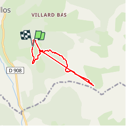

Länge
6 km

Maximale Höhe
2331 m

Positive Höhendifferenz
670 m
Km-Effort
14,9 km

Min. Höhe
1653 m

Negative Höhendifferenz
671 m
Boucle
Ja
Erstellungsdatum :
2017-08-07 00:00:00.0
Letzte Änderung :
2017-08-07 00:00:00.0
1h14
Schwierigkeit : Schwierig

Kostenlosegpshiking-Anwendung
 SityTrail
IGN / Geografische Institute
SityTrail Plus
Die Welt öffnet sich für Sie
Über SityTrail
Tour Wandern von 6 km verfügbar auf Provence-Alpes-Côte d'Azur, Alpes-de-Haute-Provence, Allos. Diese Tour wird von dadodeca vorgeschlagen.


Ort
Land:
France
Region :
Provence-Alpes-Côte d'Azur
Abteilung/Provinz :
Alpes-de-Haute-Provence
Kommune :
Allos
Standort:
Unknown
Gehen Sie:(Dec)
Gehen Sie:(UTM)
311500 ; 4900309 (32T) N.
Kommentare