![](/images/other/stat-length.png)
![Tour Wandern Montécheroux - grotte du Bisontin depuis Montécheroux - Photo](https://media.geolcdn.com/t/1900/400/ext.pjpeg?maxdim=2&url=https%3A%2F%2Fservices.sitytrail.com%2FGeolivesWS%2FDownloadMedia.ashx%3FTrailID%3D938345%26Media%3Dfix__20180407123909.jpg)
grotte du Bisontin depuis Montécheroux
margotte
Benutzer
![Länge](/images/other/stat-length.png)
Länge
10,6 km
![Maximale Höhe](https://static1.geolcdn.com/siteimages/upload/files/1508320355ic_sort_altitude_max_24dp.png)
Maximale Höhe
693 m
![Positive Höhendifferenz](https://static1.geolcdn.com/siteimages/upload/files/1508320355ic_sort_den_pos_24dp.png)
Positive Höhendifferenz
316 m
![Km-Effort](/images/other/stat-length.png)
Km-Effort
14,8 km
![Min. Höhe](https://static1.geolcdn.com/siteimages/upload/files/1508320355ic_sort_altitude_min_24dp.png)
Min. Höhe
498 m
![Negative Höhendifferenz](https://static1.geolcdn.com/siteimages/upload/files/1508320355ic_sort_den_neg_24dp.png)
Negative Höhendifferenz
316 m
![Boucle](https://static1.geolcdn.com/siteimages/upload/files/16400158638029165_repeat_loop_refresh_sync_direction_icon.png)
Boucle
Ja
Erstellungsdatum :
2019-06-11 14:15:41.208
Letzte Änderung :
2020-04-26 15:26:46.617
![Wandern](https://static1.geolcdn.com/sitytour/trail-icons/101.png)
3h12
Schwierigkeit : Einfach
![Scannen Sie diesen QR-Code, um die Tour in der SityTrail-Anwendung zu öffnen](https://capi.geolives.com/qq0zvz2zws4bq2lad0pu/sitytour/trails/938345/qr.png?size=200)
Kostenlosegpshiking-Anwendung
Über SityTrail
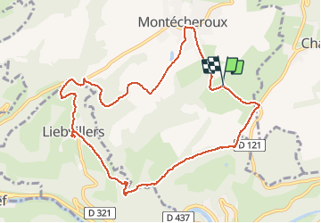
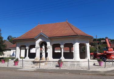
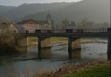
Tour Wandern von 10,6 km verfügbar auf Burgund und Freigrafschaft, Doubs, Montécheroux. Diese Tour wird von margotte vorgeschlagen.
Beschreibung
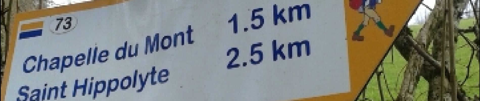
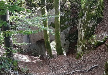
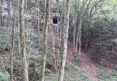
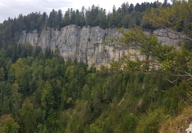
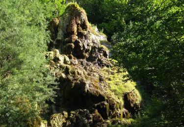
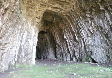
à la rencontre des premières fleurs printanière et, comme les feuilles ne sont encore pas présente, nous avons de belles vues sur la vallée du Doubs
Ort
Land:
France
Region :
Burgund und Freigrafschaft
Abteilung/Provinz :
Doubs
Kommune :
Montécheroux
Standort:
Unknown
Gehen Sie:(Dec)
Gehen Sie:(UTM)
334817 ; 5245485 (32T) N.
Kommentare
Touren in der Umgebung
![Tour Wandern Saint-Hippolyte - St Hippolyte - Grotte du Château de la Roche - Grotte du Bisontin - Photo](https://media.geolcdn.com/t/375/260/ext.jpg?maxdim=2&url=https%3A%2F%2Fmedia.geolcdn.com%2Ff%2F2305fb47-1491-4440-a67e-5e1d280ef05a.jpg)
![Wandern Wandern](https://static1.geolcdn.com/sitytour/trail-icons/101.png)
St Hippolyte - Grotte du Château de la Roche - Grotte du Bisontin
Wandern
Medium
Saint-Hippolyte,
Burgund und Freigrafschaft,
Doubs,
France
![](/images/other/stat-length.png)
14,5 km | 22 km-effort
3h 8min
![](https://static1.geolcdn.com/siteimages/upload/files/16400158638029165_repeat_loop_refresh_sync_direction_icon.png)
Ja
![Tour Mountainbike Pierrefontaine-lès-Blamont - dans le lomont et la frontière franco suisse - Photo](https://media.geolcdn.com/t/375/260/ext.jpg?maxdim=2&url=https%3A%2F%2Fservices.sitytrail.com%2FGeolivesWS%2FDownloadMedia.ashx%3FTrailID%3D819971%26Media%3Dfix__20170825140329.jpg)
![Mountainbike Mountainbike](https://static1.geolcdn.com/sitytour/trail-icons/202.png)
dans le lomont et la frontière franco suisse
Mountainbike
Schwierig
Pierrefontaine-lès-Blamont,
Burgund und Freigrafschaft,
Doubs,
France
![](/images/other/stat-length.png)
42 km | 59 km-effort
4h 38min
![](https://static1.geolcdn.com/siteimages/upload/files/16400158638029165_repeat_loop_refresh_sync_direction_icon.png)
Ja
![Tour Wandern Noirefontaine - oeil de boeuf - Photo](https://media.geolcdn.com/t/375/260/ext.jpg?maxdim=2&url=https%3A%2F%2Fstatic1.geolcdn.com%2Fsiteimages%2Fupload%2Ffiles%2F1553511878bg_sport_marche.png)
![Wandern Wandern](https://static1.geolcdn.com/sitytour/trail-icons/101.png)
oeil de boeuf
Wandern
Medium
(1)
Noirefontaine,
Burgund und Freigrafschaft,
Doubs,
France
![](/images/other/stat-length.png)
12,4 km | 17 km-effort
3h 50min
![](https://static1.geolcdn.com/siteimages/upload/files/16400158638029165_repeat_loop_refresh_sync_direction_icon.png)
Ja
![Tour Wandern Saint-Hippolyte - GTJ jour1 - Photo](https://media.geolcdn.com/t/375/260/ext.jpg?maxdim=2&url=https%3A%2F%2Fmedia.geolcdn.com%2Ff%2Fe68e1249-3703-4511-a3e8-36a20c081645.jpg)
![Wandern Wandern](https://static1.geolcdn.com/sitytour/trail-icons/101.png)
GTJ jour1
Wandern
Schwierig
Saint-Hippolyte,
Burgund und Freigrafschaft,
Doubs,
France
![](/images/other/stat-length.png)
18,6 km | 28 km-effort
7h 38min
![](https://static1.geolcdn.com/siteimages/upload/files/16400158638029165_repeat_loop_refresh_sync_direction_icon.png)
Nein
![Tour Mountainbike Saint-Hippolyte - j2 jura - Photo](https://media.geolcdn.com/t/375/260/ext.jpg?maxdim=2&url=https%3A%2F%2Fmedia.geolcdn.com%2Ff%2F51690e3a-b599-4084-8fbb-86c415aa1b7b.jpg)
![Mountainbike Mountainbike](https://static1.geolcdn.com/sitytour/trail-icons/202.png)
j2 jura
Mountainbike
Schwierig
Saint-Hippolyte,
Burgund und Freigrafschaft,
Doubs,
France
![](/images/other/stat-length.png)
51 km | 74 km-effort
4h 23min
![](https://static1.geolcdn.com/siteimages/upload/files/16400158638029165_repeat_loop_refresh_sync_direction_icon.png)
Nein
![Tour Wandern Saint-Hippolyte - Étape 3 : St Hippolyte à Fessevillers - Photo](https://media.geolcdn.com/t/375/260/ext.jpg?maxdim=2&url=https%3A%2F%2Fmedia.geolcdn.com%2Ff%2Fd2092097-8a5a-4a3f-a1ac-500089dffe06.jpg)
![Wandern Wandern](https://static1.geolcdn.com/sitytour/trail-icons/101.png)
Étape 3 : St Hippolyte à Fessevillers
Wandern
Schwierig
Saint-Hippolyte,
Burgund und Freigrafschaft,
Doubs,
France
![](/images/other/stat-length.png)
18,3 km | 28 km-effort
6h 58min
![](https://static1.geolcdn.com/siteimages/upload/files/16400158638029165_repeat_loop_refresh_sync_direction_icon.png)
Nein
![Tour Wandern Villars-lès-Blamont - Sappois - Photo](https://media.geolcdn.com/t/375/260/ext.jpg?maxdim=2&url=https%3A%2F%2Fservices.sitytrail.com%2FGeolivesWS%2FDownloadMedia.ashx%3FTrailID%3D705523%26Media%3Dfix__20170226134415.jpg)
![Wandern Wandern](https://static1.geolcdn.com/sitytour/trail-icons/101.png)
Sappois
Wandern
Medium
Villars-lès-Blamont,
Burgund und Freigrafschaft,
Doubs,
France
![](/images/other/stat-length.png)
15,7 km | 23 km-effort
5h 15min
![](https://static1.geolcdn.com/siteimages/upload/files/16400158638029165_repeat_loop_refresh_sync_direction_icon.png)
Ja
![Tour Laufen Chamesol - grotte du château des roches - Photo](https://media.geolcdn.com/t/375/260/ext.jpg?maxdim=2&url=https%3A%2F%2Fservices.sitytrail.com%2FGeolivesWS%2FDownloadMedia.ashx%3FTrailID%3D266382%26Media%3Dfix__20140413165405.jpg)
![Laufen Laufen](https://static1.geolcdn.com/sitytour/trail-icons/103.png)
grotte du château des roches
Laufen
Einfach
Chamesol,
Burgund und Freigrafschaft,
Doubs,
France
![](/images/other/stat-length.png)
9,1 km | 14,2 km-effort
2h 57min
![](https://static1.geolcdn.com/siteimages/upload/files/16400158638029165_repeat_loop_refresh_sync_direction_icon.png)
Ja
![Tour Wandern Soulce-Cernay - la grotte - Photo](https://media.geolcdn.com/t/375/260/ext.jpg?maxdim=2&url=https%3A%2F%2Fservices.sitytrail.com%2FGeolivesWS%2FDownloadMedia.ashx%3FTrailID%3D255992%26Media%3Dfix__20140310164415.jpg)
![Wandern Wandern](https://static1.geolcdn.com/sitytour/trail-icons/101.png)
la grotte
Wandern
Medium
Soulce-Cernay,
Burgund und Freigrafschaft,
Doubs,
France
![](/images/other/stat-length.png)
6,6 km | 11,1 km-effort
2h 24min
![](https://static1.geolcdn.com/siteimages/upload/files/16400158638029165_repeat_loop_refresh_sync_direction_icon.png)
Ja