Steffeln, Landkreis Vulkaneifel: Best trails, routes and walks

1 comments

Steffeln: Discover the best trails: 3 hiking trails. All these trails, routes and outdoor activities are available in our SityTrail applications for smartphones and tablets.


The best trails (3)

Trail On foot Steffeln - Georundweg Steffeln - Photo
On foot 10.653
Km
PRO

On foot

Easy
(1)
Steffeln, Rhineland-Palatinate, Landkreis Vulkaneifel, Germany
10.7 km | 13.3 km-effort
3h 1min
199 m
198 m
Yes
SityTrail - itinéraires balisés pédestres

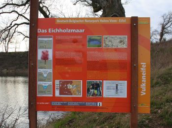
• eichholzmaar, steffeln, duppach, vulkangarten, geo, rundweg, wandern, vulakneifel, natur, geologie, maare, dreese, vu...

Trail On foot Steffeln - Stelleln Nr. 2 - Photo
On foot 6.555
Km
PRO

On foot

Easy
Steffeln, Rhineland-Palatinate, Landkreis Vulkaneifel, Germany
6.6 km | 7.8 km-effort
1h 46min
95 m
92 m
No
SityTrail - itinéraires balisés pédestres

• Trail created by Eifelverein. Symbol: Schwarze 2 auf weißem Grund

Trail On foot Steffeln - Stelleln 1 - Photo
On foot 4.348
Km
PRO

On foot

Easy
Steffeln, Rhineland-Palatinate, Landkreis Vulkaneifel, Germany
4.3 km | 5.7 km-effort
1h 18min
127 m
32 m
No
SityTrail - itinéraires balisés pédestres

• Trail created by Eifelverein. Symbol: Schwarze 1 auf weißem Grund (oben: Eifelverein, unten: Steffeln)

3 trails displayed on 3

FREE GPS app for hiking

Logo SityTrail SityTrail

IGN / Geographical institutes

Download SityTrail from the App Store Download SityTrail from Google Play

Logo SityTrail SityTrail World

The world is yours!

Download SityTrail from the App Store Download SityTrail from Google Play Download SityTrail on Huawei AppGallery

Activities

Close
My subscriptions