Le Bonhomme, Haut-Rhin: Best trails, routes and walks

18 comments

Le Bonhomme: Discover the best trails: 133 hiking trails, 13 bike and mountain-bike routes and 3 equestrian circuits. All these trails, routes and outdoor activities are available in our SityTrail applications for smartphones and tablets.


The best trails (181)

Trail Walking Le Bonhomme - Tête des faux . - Photo
Walking 11.896
Km

Walking

Medium
(1)
Le Bonhomme, Grand Est, Haut-Rhin, France
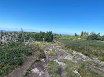
11.9 km | 16.6 km-effort
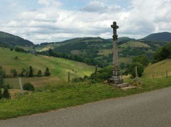
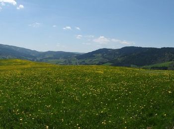
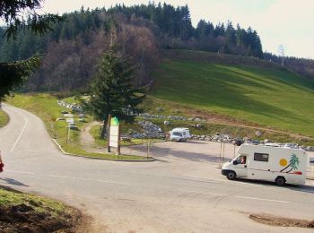
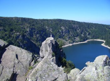
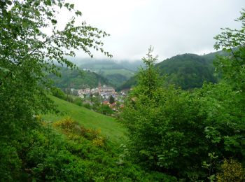
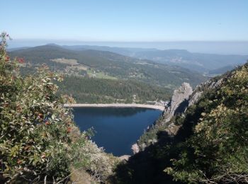
3h 46min
356 m
357 m
Yes
heurtinpatrick

Trail Walking Le Bonhomme - Le Bonhomme - Circuit du village - Photo
Walking 3.008
Km
GUIDE

Walking

Easy
(1)
Le Bonhomme, Grand Est, Haut-Rhin, France
3 km | 5.3 km-effort
1h 30min
174 m
179 m
Yes
Desrumaux

• Détails de la rando sur TraceGPS.com http://www.tracegps.com/fr/parcours/circuit11228.htm

Trail Walking Le Bonhomme - Lac blanc col du calvaire - Photo
Walking 4.957
Km

Walking

Le Bonhomme, Grand Est, Haut-Rhin, France
5 km | 7.2 km-effort
2h 13min
172 m
172 m
Yes
FOUCAULT

Trail Walking Le Bonhomme - Col du calvaire Bonhomme Lac Blanc - Photo
Walking 15.004
Km

Walking

Easy
Le Bonhomme, Grand Est, Haut-Rhin, France
15 km | 22 km-effort
3h 9min
513 m
511 m
Yes
oscar1

Trail Walking Le Bonhomme - Le  Bonhomme-le Brézouard - Photo
Walking 15.001
Km

Walking

Medium
Le Bonhomme, Grand Est, Haut-Rhin, France
15 km | 26 km-effort
4h 34min
794 m
800 m
Yes
oscar1

Trail Walking Le Bonhomme - les 3 lacs au départ du col du calvaire - Photo
Walking 12.53
Km

Walking

Medium
Le Bonhomme, Grand Est, Haut-Rhin, France
12.5 km | 18.8 km-effort
3h 29min
467 m
473 m
Yes
olivier78000

Trail Walking Le Bonhomme - 2020-06-18 DW10+ Col du calvaire / Etang du Devin / Carrefour Duschene - Photo
Walking 12.793
Km

Walking

Medium
(1)
Le Bonhomme, Grand Est, Haut-Rhin, France
12.8 km | 18.1 km-effort
3h 30min
397 m
399 m
Yes
ABICHE

Trail Walking Le Bonhomme - Circuit de la Tête des Faux - Photo
Walking 11.989
Km

Walking

Medium
Le Bonhomme, Grand Est, Haut-Rhin, France
12 km | 19.8 km-effort
4h 0min
588 m
590 m
Yes
VacheKiri67

Trail Mountain bike Le Bonhomme - Le Grand Tour du Bonhomme (avec restaurant) - Photo
Mountain bike 32.041
Km

Mountain bike

Medium
Le Bonhomme, Grand Est, Haut-Rhin, France
32 km | 45 km-effort
3h 54min
997 m
998 m
Yes
sit68000

Trail On foot Le Bonhomme - Col des Bagenelles - Haïcot - Petit Brézouard - Grand Brézouard et retour - Photo
On foot 9.665
Km

On foot

Medium
(1)
Le Bonhomme, Grand Est, Haut-Rhin, France
9.7 km | 15 km-effort
Unknown
397 m
398 m
Yes
patrickbeyrath

Trail Walking Le Bonhomme - 2019-01-19 Marche Neige Gazon du Faing - Photo
Walking 10.252
Km
GUIDE

Walking

Easy
Le Bonhomme, Grand Est, Haut-Rhin, France
10.3 km | 13.7 km-effort
3h 0min
259 m
259 m
Yes
holtzv

Trail Snowshoes Le Bonhomme - Col du calvaire-Etang du Devin - Photo
Snowshoes 13.101
Km

Snowshoes

Difficult
(2)
Le Bonhomme, Grand Est, Haut-Rhin, France
13.1 km | 18.9 km-effort
4h 0min
431 m
436 m
Yes
JulianeSCHAAL

Trail Walking Le Bonhomme - 2014-06-17 Lacs Blanc et Noir - Photo
Walking 9.472
Km

Walking

Medium
(1)
Le Bonhomme, Grand Est, Haut-Rhin, France
9.5 km | 14.5 km-effort
3h 14min
376 m
377 m
Yes
bmorel@orange.fr

Trail Mountain bike Le Bonhomme - Le grand tour du Bonhomme 1 - Le Bonhomme  - Photo
Mountain bike 32.374
Km

Mountain bike

Difficult
Le Bonhomme, Grand Est, Haut-Rhin, France
32 km | 46 km-effort
4h 30min
990 m
993 m
Yes
tracegps

Trail Snowshoes Le Bonhomme - Raquettes vers la Tête du Violu - le Bonhomme - Photo
Snowshoes 11.423
Km

Snowshoes

Medium
Le Bonhomme, Grand Est, Haut-Rhin, France
11.4 km | 18.4 km-effort
4h 0min
524 m
526 m
Yes
tracegps

Trail Mountain bike Le Bonhomme - Les Bagenelles - Le Bonhomme - Photo
Mountain bike 14.185
Km

Mountain bike

Medium
Le Bonhomme, Grand Est, Haut-Rhin, France
14.2 km | 19.7 km-effort
1h 45min
413 m
415 m
Yes
tracegps

Trail Mountain bike Le Bonhomme - Le grand tour du Bonhomme - Photo
Mountain bike 32.52
Km

Mountain bike

Difficult
(1)
Le Bonhomme, Grand Est, Haut-Rhin, France
33 km | 46 km-effort
4h 30min
991 m
993 m
Yes
tracegps

Trail Walking Le Bonhomme - Descente du Col des Bagenelles vers la Hollée - Photo
Walking 2.342
Km
GUIDE

Walking

Very easy
(2)
Le Bonhomme, Grand Est, Haut-Rhin, France
2.3 km | 3.2 km-effort
45min
36 m
154 m
No
pscheven

Trail Walking Le Bonhomme - Le Bonhomme - Circuit du village - Photo
Walking 3.008
Km

Walking

Medium
Le Bonhomme, Grand Est, Haut-Rhin, France
3 km | 5.3 km-effort
1h 30min
174 m
179 m
Yes
tracegps

Trail Walking Le Bonhomme - 2023-10-01 Lacs Blanc-Noir-Forlet - Photo
Walking 15.416
Km

Walking

Medium
Le Bonhomme, Grand Est, Haut-Rhin, France
15.4 km | 23 km-effort
4h 31min
536 m
535 m
Yes
Mich&Agnès

20 trails displayed on 181

FREE GPS app for hiking

Logo SityTrail SityTrail

IGN / Geographical institutes

Download SityTrail from the App Store Download SityTrail from Google Play

Logo SityTrail SityTrail World

The world is yours!

Download SityTrail from the App Store Download SityTrail from Google Play Download SityTrail on Huawei AppGallery

Activities

Close
My subscriptions