Valbrenta, Vicenza: Best trails, routes and walks

Valbrenta: Discover the best trails: 15 hiking trails. All these trails, routes and outdoor activities are available in our SityTrail applications for smartphones and tablets.


The best trails (15)
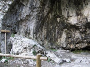
Trail On foot Valbrenta - Oliero di Sotto - Le Pozzette - Col d'Astiago - Photo
On foot 4.992
Km
PRO

On foot

Easy
Valbrenta, Veneto, Vicenza, Italy
5 km | 15.8 km-effort
3h 35min
1081 m
8 m
No
SityTrail - itinéraires balisés pédestres

• Symbol: 771 on white red flag Website: http://www.caimarostica.it

Trail On foot Valbrenta - Oliero di Sopra - Le Pozzette - Col d'Astiago - Photo
On foot 4.54
Km
PRO

On foot

Easy
Valbrenta, Veneto, Vicenza, Italy
4.5 km | 15.2 km-effort
3h 27min
1067 m
3 m
No
SityTrail - itinéraires balisés pédestres

• Symbol: 773 on white red flag Website: http://www.caimarostica.it

Trail On foot Valbrenta - Tovi - Valle Ranetta - C. Ralova - Monte Campolongo - Photo
On foot 6.381
Km
PRO

On foot

Easy
Valbrenta, Veneto, Vicenza, Italy
6.4 km | 16.5 km-effort
3h 44min
999 m
37 m
No
SityTrail - itinéraires balisés pédestres

• Trail created by Campolongo sul Brenta. Symbol: 769 on white red flag Website: http://www.caimarostica.it

Trail On foot Valbrenta - Sannazara - Photo
On foot 4.309
Km
PRO

On foot

Easy
Valbrenta, Veneto, Vicenza, Italy
4.3 km | 15.8 km-effort
3h 35min
1151 m
0 m
No
SityTrail - itinéraires balisés pédestres

• Trail created by Club Alpino Italiano. Symbol: 938 on white red flag Website: http://www.caibassanograppa.com
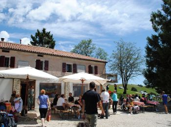
Trail On foot Valbrenta - Moschina - Photo
On foot 4.846
Km
PRO

On foot

Easy
Valbrenta, Veneto, Vicenza, Italy
4.8 km | 15.9 km-effort
3h 37min
1107 m
5 m
No
SityTrail - itinéraires balisés pédestres

• Trail created by Club Alpino Italiano. Symbol: 936 on white red flag Website: http://www.caibassanograppa.com

Trail On foot Valbrenta - Colli Asoloni - Photo
On foot 12.188
Km
PRO

On foot

Medium
Valbrenta, Veneto, Vicenza, Italy
12.2 km | 30 km-effort
6h 45min
1642 m
338 m
No
SityTrail - itinéraires balisés pédestres

• Trail created by Club Alpino Italiano. Symbol: 920 on white red flag Website: http://www.caibassanograppa.com
Trail On foot Valbrenta - Mori (Valstagna) - Monte Cornone - Sasso Rosso - Photo
On foot 3.483
Km
PRO

On foot

Easy
Valbrenta, Veneto, Vicenza, Italy
3.5 km | 13.7 km-effort
3h 6min
1020 m
7 m
No
SityTrail - itinéraires balisés pédestres

• Symbol: 781 on white red flag Website: http://www.caimarostica.it

Trail On foot Valbrenta - Campolongo sul Brenta - Casare di Campolongo - Monte Campolongo - Photo
On foot 5.71
Km
PRO

On foot

Easy
Valbrenta, Veneto, Vicenza, Italy
5.7 km | 15.8 km-effort
3h 35min
999 m
40 m
No
SityTrail - itinéraires balisés pédestres

• Trail created by Campolongo sul Brenta. Symbol: 765 on white red flag Website: http://www.caimarostica.it

Trail On foot Valbrenta - Valgadena - Lessi - Stoner - Photo
On foot 5.816
Km
PRO

On foot

Easy
Valbrenta, Veneto, Vicenza, Italy
5.8 km | 16.9 km-effort
3h 50min
1037 m
215 m
No
SityTrail - itinéraires balisés pédestres

• Symbol: 784 on white red flag Website: http://www.caimarostica.it

Trail On foot Valbrenta - Costa - Valgoda - Photo
On foot 3.166
Km
PRO

On foot

Easy
Valbrenta, Veneto, Vicenza, Italy
3.2 km | 9.8 km-effort
2h 13min
659 m
17 m
No
SityTrail - itinéraires balisés pédestres

• Symbol: 787 on white red flag Website: http://www.caimarostica.it

Trail On foot Valbrenta - Col dei Prai - Photo
On foot 3.337
Km
PRO

On foot

Easy
Valbrenta, Veneto, Vicenza, Italy
3.3 km | 6.7 km-effort
1h 31min
339 m
2 m
No
SityTrail - itinéraires balisés pédestres

• Trail created by Club Alpino Italiano. Symbol: 910 on white red flag Website: http://www.caibassanograppa.com

Trail On foot Valbrenta - Le Aste Rosse - Photo
On foot 3.486
Km
PRO

On foot

Easy
Valbrenta, Veneto, Vicenza, Italy
3.5 km | 6.1 km-effort
1h 23min
11 m
760 m
No
SityTrail - itinéraires balisés pédestres

• Trail created by Club Alpino Italiano. Symbol: 935 on white red flag Website: http://www.caibassanograppa.com

Trail On foot Valbrenta - IT-929 - Photo
On foot 3.417
Km
PRO

On foot

Easy
Valbrenta, Veneto, Vicenza, Italy
3.4 km | 13.8 km-effort
3h 8min
1042 m
1 m
No
SityTrail - itinéraires balisés pédestres

• Trail created by Club Alpino Italiano. Symbol: 929 on white red flag Website: http://www.caibassanograppa.com

Trail Walking Valbrenta - Escursione San Nazario-Col Moschin - Photo
Walking 8.342
Km
GUIDE

Walking

Easy
Valbrenta, Veneto, Vicenza, Italy
8.3 km | 23 km-effort
Unknown
1129 m
1129 m
Yes
rvapeldo

Trail Walking Valbrenta - Prima Marcia Sui Sentieri d'Autunno 8 Nov 2015 - Photo
Walking 7.169
Km
GUIDE

Walking

Easy
Valbrenta, Veneto, Vicenza, Italy
7.2 km | 12.9 km-effort
Unknown
428 m
429 m
Yes
rvapeldo

15 trails displayed on 15

FREE GPS app for hiking

Logo SityTrail SityTrail

IGN / Geographical institutes

Download SityTrail from the App Store Download SityTrail from Google Play

Logo SityTrail SityTrail World

The world is yours!

Download SityTrail from the App Store Download SityTrail from Google Play Download SityTrail on Huawei AppGallery

Activities

Close
My subscriptions