


belfahy

cyrghe
User
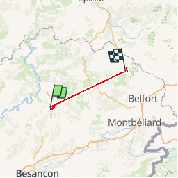

Length
70 km

Max alt
942 m

Uphill gradient
2451 m
Km-Effort
100 km

Min alt
226 m

Downhill gradient
1896 m
Boucle
No
Creation date :
2019-01-15 12:43:00.73
Updated on :
2019-01-15 12:43:00.73
5h29
Difficulty : Easy

FREE GPS app for hiking
 SityTrail
IGN / Geographical institutes
SityTrail Plus
The world is yours!
About
Trail Walking of 70 km to be discovered at Bourgogne-Franche-Comté, Haute-Saône, Échenoz-la-Méline. This trail is proposed by cyrghe.
Description
Belfahy
Positioning
Country:
France
Region :
Bourgogne-Franche-Comté
Department/Province :
Haute-Saône
Municipality :
Échenoz-la-Méline
Location:
Unknown
Start:(Dec)
Start:(UTM)
284529 ; 5274670 (32T) N.
Comments