


batteriesBear_T

force
User
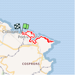

Length
12.3 km

Max alt
117 m

Uphill gradient
290 m
Km-Effort
16.2 km

Min alt
-2 m

Downhill gradient
291 m
Boucle
Yes
Creation date :
2018-08-12 10:18:13.484
Updated on :
2018-08-12 10:18:13.51
3h30
Difficulty : Unknown

FREE GPS app for hiking
 SityTrail
IGN / Geographical institutes
SityTrail Plus
The world is yours!
About
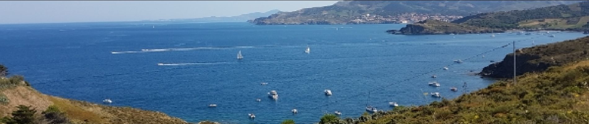
Trail Walking of 12.3 km to be discovered at Occitania, Pyrénées-Orientales, Collioure. This trail is proposed by force.
Description
côte rocheuse
Photos


Positioning
Country:
France
Region :
Occitania
Department/Province :
Pyrénées-Orientales
Municipality :
Collioure
Location:
Unknown
Start:(Dec)
Start:(UTM)
507937 ; 4707940 (31T) N.
Comments