


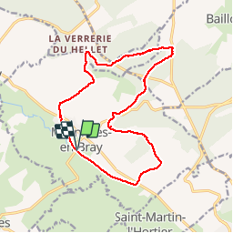
Mesnieres en Bray par le Hellet

MichelRando7656
User

Length
15 km

Max alt
225 m

Uphill gradient
303 m
Km-Effort
19 km

Min alt
60 m

Downhill gradient
303 m
Boucle
Yes
Creation date :
2019-04-29 10:39:36.381
Updated on :
2019-04-29 10:39:36.55
3h20
Difficulty : Medium

FREE GPS app for hiking
 SityTrail
IGN / Geographical institutes
SityTrail Plus
The world is yours!
About
Trail Walking of 15 km to be discovered at Normandy, Seine-Maritime, Mesnières-en-Bray. This trail is proposed by MichelRando7656.
Description
Voie verte, chemins rocailleux et en sous bois ombragés ou en plein soleil
Positioning
Country:
France
Region :
Normandy
Department/Province :
Seine-Maritime
Municipality :
Mesnières-en-Bray
Location:
Unknown
Start:(Dec)
Start:(UTM)
383332 ; 5513293 (31U) N.
Comments