


20180703_lacs_de_trmpetr

nfranche
User
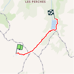

Length
7.2 km

Max alt
2168 m

Uphill gradient
169 m
Km-Effort
11.2 km

Min alt
1543 m

Downhill gradient
693 m
Boucle
No
Creation date :
2019-01-15 12:44:31.282
Updated on :
2019-06-01 16:17:12.141
2h01
Difficulty : Medium

FREE GPS app for hiking
 SityTrail
IGN / Geographical institutes
SityTrail Plus
The world is yours!
About
Trail Walking of 7.2 km to be discovered at Auvergne-Rhône-Alpes, Savoy, Cevins. This trail is proposed by nfranche.
Positioning
Country:
France
Region :
Auvergne-Rhône-Alpes
Department/Province :
Savoy
Municipality :
Cevins
Location:
Unknown
Start:(Dec)
Start:(UTM)
307831 ; 5055034 (32T) N.
Comments