


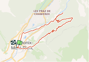
Chamonix vers l'Arveyron..les Mottets..et retour

r.genette
User

Length
11.1 km

Max alt
1496 m

Uphill gradient
497 m
Km-Effort
17.8 km

Min alt
1037 m

Downhill gradient
496 m
Boucle
Yes
Creation date :
2019-01-15 12:52:00.972
Updated on :
2019-01-15 12:52:00.972
3h37
Difficulty : Unknown

FREE GPS app for hiking
 SityTrail
IGN / Geographical institutes
SityTrail Plus
The world is yours!
About
Trail Other activity of 11.1 km to be discovered at Auvergne-Rhône-Alpes, Upper Savoy, Chamonix-Mont-Blanc. This trail is proposed by r.genette.
Description
passage par la bergerie..route barrée..traversée de la colline..pour retrouver le sentier des Mottets...redescendre vers le parking des Planards..et retour
Positioning
Country:
France
Region :
Auvergne-Rhône-Alpes
Department/Province :
Upper Savoy
Municipality :
Chamonix-Mont-Blanc
Location:
Unknown
Start:(Dec)
Start:(UTM)
334740 ; 5087723 (32T) N.
Comments