


chaillol col du vialet

dadodeca
User

Length
13.2 km

Max alt
2238 m

Uphill gradient
812 m
Km-Effort
24 km

Min alt
1571 m

Downhill gradient
796 m
Boucle
No
Creation date :
2019-01-15 13:09:14.935
Updated on :
2019-01-15 13:09:14.935
3h25
Difficulty : Medium

FREE GPS app for hiking
 SityTrail
IGN / Geographical institutes
SityTrail Plus
The world is yours!
About
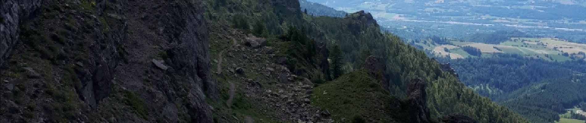
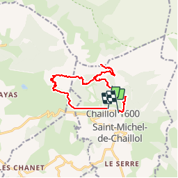
Trail Walking of 13.2 km to be discovered at Provence-Alpes-Côte d'Azur, Hautes-Alpes, Saint-Michel-de-Chaillol. This trail is proposed by dadodeca.
Photos


Positioning
Country:
France
Region :
Provence-Alpes-Côte d'Azur
Department/Province :
Hautes-Alpes
Municipality :
Saint-Michel-de-Chaillol
Location:
Unknown
Start:(Dec)
Start:(UTM)
275030 ; 4952445 (32T) N.
Comments