


180720 aoste . valgrisenche bonne . meillares .A-R

stef789
User GUIDE
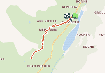

Length
8.6 km

Max alt
2394 m

Uphill gradient
543 m
Km-Effort
15.8 km

Min alt
1854 m

Downhill gradient
542 m
Boucle
Yes
Creation date :
2019-01-15 13:17:29.544
Updated on :
2019-01-15 13:17:29.544
4h36
Difficulty : Medium

FREE GPS app for hiking
 SityTrail
IGN / Geographical institutes
SityTrail Plus
The world is yours!
About
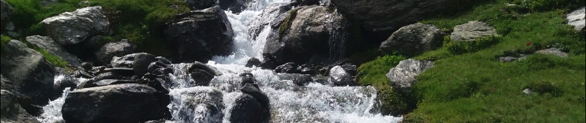
Trail Walking of 8.6 km to be discovered at Aosta Valley, Unknown, Valgrisenche. This trail is proposed by stef789.
Photos


Positioning
Country:
Italy
Region :
Aosta Valley
Department/Province :
Unknown
Municipality :
Valgrisenche
Location:
Unknown
Start:(Dec)
Start:(UTM)
348134 ; 5052965 (32T) N.
Comments