


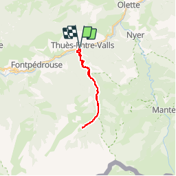
La_carancaRefuge_A-R_T

force
User


7h55
Difficulty : Unknown

FREE GPS app for hiking
 SityTrail
IGN / Geographical institutes
SityTrail Plus
The world is yours!
About
Trail Walking of 19.9 km to be discovered at Occitania, Pyrénées-Orientales, Thuès-Entre-Valls. This trail is proposed by force.
Description
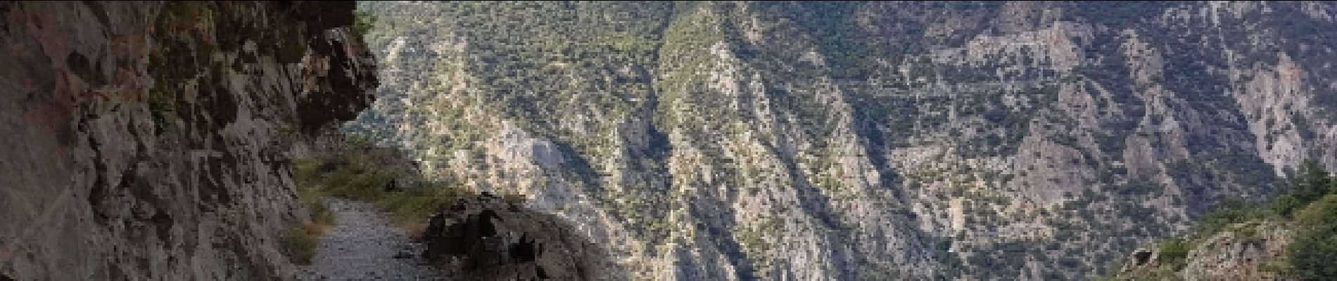
A-R dans les gorges jusqu'au refuge du Ras.
Rando de longueur variable selon disponibilités car l'A-R se fait par les gorges.
Photos


33 photos in total. Please click on a photo to see them all in the gallery.
Positioning
Comments