


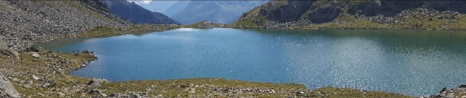
le col des 7 laux en A- R

jeanboulay
User
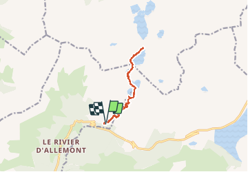

Length
12.5 km

Max alt
2220 m

Uphill gradient
986 m
Km-Effort
26 km

Min alt
1257 m

Downhill gradient
998 m
Boucle
Yes
Creation date :
2019-01-15 14:03:16.938
Updated on :
2020-07-31 13:42:27.996
5h04
Difficulty : Difficult

FREE GPS app for hiking
 SityTrail
IGN / Geographical institutes
SityTrail Plus
The world is yours!
About
Trail Walking of 12.5 km to be discovered at Auvergne-Rhône-Alpes, Isère, Allemond. This trail is proposed by jeanboulay.
Photos


Positioning
Country:
France
Region :
Auvergne-Rhône-Alpes
Department/Province :
Isère
Municipality :
Allemond
Location:
Unknown
Start:(Dec)
Start:(UTM)
269370 ; 5010550 (32T) N.
Comments