


Mont Charvin en boucle

jeanboulay
User
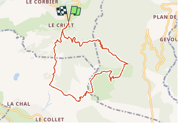

Length
9.6 km

Max alt
2197 m

Uphill gradient
886 m
Km-Effort
21 km

Min alt
1354 m

Downhill gradient
890 m
Boucle
Yes
Creation date :
2019-01-15 14:03:18.174
Updated on :
2020-07-31 13:42:25.777
4h00
Difficulty : Difficult

FREE GPS app for hiking
 SityTrail
IGN / Geographical institutes
SityTrail Plus
The world is yours!
About
Trail Walking of 9.6 km to be discovered at Auvergne-Rhône-Alpes, Savoy, Villarembert. This trail is proposed by jeanboulay.
Positioning
Country:
France
Region :
Auvergne-Rhône-Alpes
Department/Province :
Savoy
Municipality :
Villarembert
Location:
Unknown
Start:(Dec)
Start:(UTM)
286314 ; 5012693 (32T) N.
Comments