


Refuge de Moëde Anterne depuis Refuge Bellachat

gregou74
User

Length
11.6 km

Max alt
2487 m

Uphill gradient
773 m
Km-Effort
22 km

Min alt
1594 m

Downhill gradient
934 m
Boucle
No
Creation date :
2019-04-27 13:17:03.974
Updated on :
2019-04-27 13:17:04.027
4h23
Difficulty : Medium

FREE GPS app for hiking
 SityTrail
IGN / Geographical institutes
SityTrail Plus
The world is yours!
About
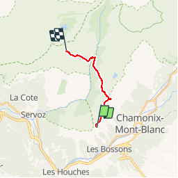
Trail Walking of 11.6 km to be discovered at Auvergne-Rhône-Alpes, Upper Savoy, Chamonix-Mont-Blanc. This trail is proposed by gregou74.
Description
Tour des Aiguilles Rouges - Jour 3
Positioning
Country:
France
Region :
Auvergne-Rhône-Alpes
Department/Province :
Upper Savoy
Municipality :
Chamonix-Mont-Blanc
Location:
Unknown
Start:(Dec)
Start:(UTM)
331709 ; 5087690 (32T) N.
Comments