


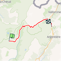
Col des Montets depuis Refuge de Moëde Anterne

gregou74
User

Length
16.3 km

Max alt
2512 m

Uphill gradient
817 m
Km-Effort
29 km

Min alt
1386 m

Downhill gradient
1353 m
Boucle
No
Creation date :
2019-04-27 13:17:03.536
Updated on :
2019-04-27 13:17:03.692
5h33
Difficulty : Difficult

FREE GPS app for hiking
 SityTrail
IGN / Geographical institutes
SityTrail Plus
The world is yours!
About
Trail Walking of 16.3 km to be discovered at Auvergne-Rhône-Alpes, Upper Savoy, Passy. This trail is proposed by gregou74.
Description
Tour des Aiguilles Rouges - Jour 4
Positioning
Country:
France
Region :
Auvergne-Rhône-Alpes
Department/Province :
Upper Savoy
Municipality :
Passy
Location:
Unknown
Start:(Dec)
Start:(UTM)
329616 ; 5093627 (32T) N.
Comments