


mont dauphin - citadelle vauban

stef789
User GUIDE
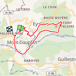

Length
7.5 km

Max alt
1046 m

Uphill gradient
212 m
Km-Effort
10.4 km

Min alt
890 m

Downhill gradient
219 m
Boucle
Yes
Creation date :
2019-01-15 14:07:16.136
Updated on :
2019-01-15 14:07:16.136
2h14
Difficulty : Easy

FREE GPS app for hiking
 SityTrail
IGN / Geographical institutes
SityTrail Plus
The world is yours!
About
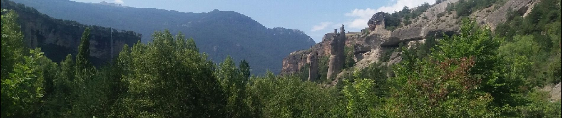
Trail Walking of 7.5 km to be discovered at Provence-Alpes-Côte d'Azur, Hautes-Alpes, Eygliers. This trail is proposed by stef789.
Photos


Positioning
Country:
France
Region :
Provence-Alpes-Côte d'Azur
Department/Province :
Hautes-Alpes
Municipality :
Eygliers
Location:
Unknown
Start:(Dec)
Start:(UTM)
311354 ; 4949252 (32T) N.
Comments