


La Jonction

r.genette
User
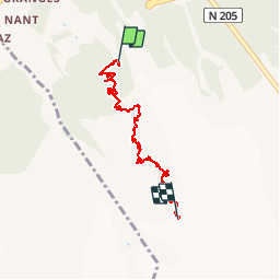

Length
6.4 km

Max alt
2580 m

Uphill gradient
1236 m
Km-Effort
19.1 km

Min alt
1413 m

Downhill gradient
108 m
Boucle
No
Creation date :
2019-01-15 14:24:25.111
Updated on :
2019-01-15 14:24:25.111
3h46
Difficulty : Very difficult

FREE GPS app for hiking
 SityTrail
IGN / Geographical institutes
SityTrail Plus
The world is yours!
About
Trail Walking of 6.4 km to be discovered at Auvergne-Rhône-Alpes, Upper Savoy, Chamonix-Mont-Blanc. This trail is proposed by r.genette.
Description
revoir ce que j'avais vu en 1994 le final est très difficile.... content...y
Positioning
Country:
France
Region :
Auvergne-Rhône-Alpes
Department/Province :
Upper Savoy
Municipality :
Chamonix-Mont-Blanc
Location:
Unknown
Start:(Dec)
Start:(UTM)
333120 ; 5084485 (32T) N.
Comments