


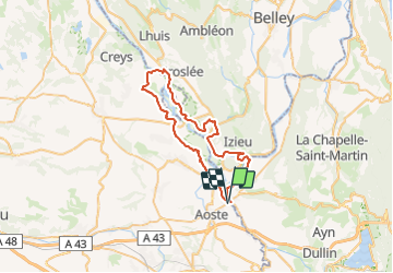
St Genix - Groslée

leeho
User

Length
53 km

Max alt
239 m

Uphill gradient
372 m
Km-Effort
58 km

Min alt
202 m

Downhill gradient
372 m
Boucle
Yes
Creation date :
2019-01-15 14:29:42.521
Updated on :
2019-01-15 14:29:42.521
3h27
Difficulty : Easy

FREE GPS app for hiking
 SityTrail
IGN / Geographical institutes
SityTrail Plus
The world is yours!
About
Trail Cycle of 53 km to be discovered at Auvergne-Rhône-Alpes, Isère, Aoste. This trail is proposed by leeho.
Description
De St Genix-sur-Guiers à Groslée en VAE
Positioning
Country:
France
Region :
Auvergne-Rhône-Alpes
Department/Province :
Isère
Municipality :
Aoste
Location:
Unknown
Start:(Dec)
Start:(UTM)
705042 ; 5052634 (31T) N.
Comments