


2018 brabant 4

norihtom
User
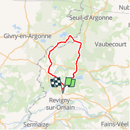

Length
30 km

Max alt
201 m

Uphill gradient
309 m
Km-Effort
35 km

Min alt
140 m

Downhill gradient
310 m
Boucle
Yes
Creation date :
2019-01-15 14:43:58.077
Updated on :
2019-01-15 14:43:58.077
2h02
Difficulty : Unknown

FREE GPS app for hiking
 SityTrail
IGN / Geographical institutes
SityTrail Plus
The world is yours!
About
Trail Cycle of 30 km to be discovered at Grand Est, Meuse, Brabant-le-Roi. This trail is proposed by norihtom.
Positioning
Country:
France
Region :
Grand Est
Department/Province :
Meuse
Municipality :
Brabant-le-Roi
Location:
Unknown
Start:(Dec)
Start:(UTM)
645572 ; 5412279 (31U) N.
Comments