


Pic des Rives

rigol05
User
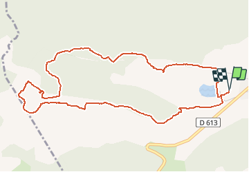

Length
6.4 km

Max alt
1441 m

Uphill gradient
407 m
Km-Effort
11.8 km

Min alt
1032 m

Downhill gradient
406 m
Boucle
Yes
Creation date :
2019-01-15 14:45:37.33
Updated on :
2019-01-15 14:45:37.33
2h22
Difficulty : Easy

FREE GPS app for hiking
 SityTrail
IGN / Geographical institutes
SityTrail Plus
The world is yours!
About
Trail Walking of 6.4 km to be discovered at Occitania, Aude, Belcaire. This trail is proposed by rigol05.
Description
Séjour Pyrénées audoises
sortie du 07/08/2018
Itinéraire balisé "Pays de Sault"
Positioning
Country:
France
Region :
Occitania
Department/Province :
Aude
Municipality :
Belcaire
Location:
Unknown
Start:(Dec)
Start:(UTM)
414193 ; 4740997 (31T) N.
Comments