


*Port Royal des champs et le château de La Madeleine

jpcccb
User

Length
17.3 km

Max alt
177 m

Uphill gradient
352 m
Km-Effort
22 km

Min alt
76 m

Downhill gradient
350 m
Boucle
Yes
Creation date :
2019-01-15 14:58:02.156
Updated on :
2023-05-29 09:05:14.228
4h59
Difficulty : Very difficult

FREE GPS app for hiking
 SityTrail
IGN / Geographical institutes
SityTrail Plus
The world is yours!
About
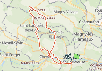
Trail Walking of 17.3 km to be discovered at Ile-de-France, Yvelines, Saint-Rémy-lès-Chevreuse. This trail is proposed by jpcccb.
Description
Bords de l'Yvette, Milon la chapelle, Abbaye de Port Royal de champs, Parc naturel régional de la haute vallée de Chevreuse, Chateau de la Madeleine.
Positioning
Country:
France
Region :
Ile-de-France
Department/Province :
Yvelines
Municipality :
Saint-Rémy-lès-Chevreuse
Location:
Unknown
Start:(Dec)
Start:(UTM)
431585 ; 5394843 (31U) N.
Comments