


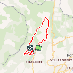
Balcon gapençais sous les crêtes de Charance

rigol05
User

Length
12.5 km

Max alt
1419 m

Uphill gradient
430 m
Km-Effort
18.3 km

Min alt
1056 m

Downhill gradient
429 m
Boucle
Yes
Creation date :
2019-01-15 14:58:05.134
Updated on :
2019-01-15 14:58:05.134
3h53
Difficulty : Medium

FREE GPS app for hiking
 SityTrail
IGN / Geographical institutes
SityTrail Plus
The world is yours!
About
Trail Walking of 12.5 km to be discovered at Provence-Alpes-Côte d'Azur, Hautes-Alpes, Gap. This trail is proposed by rigol05.
Description
Sortie du 20/08/2018
Modification de l'itinéraire. A hauteur de la carrière des Serrigues, prendre la route sur la gauche pour rejoindre les Brunets
Positioning
Country:
France
Region :
Provence-Alpes-Côte d'Azur
Department/Province :
Hautes-Alpes
Municipality :
Gap
Location:
Gap
Start:(Dec)
Start:(UTM)
266541 ; 4940729 (32T) N.
Comments