


plomb du cantal - puy du Rocher

maupassant38
User
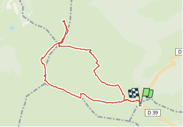

Length
9.9 km

Max alt
1839 m

Uphill gradient
514 m
Km-Effort
16.8 km

Min alt
1386 m

Downhill gradient
511 m
Boucle
Yes
Creation date :
2019-02-22 22:30:30.631
Updated on :
2019-02-22 22:30:30.645
3h09
Difficulty : Medium

FREE GPS app for hiking
 SityTrail
IGN / Geographical institutes
SityTrail Plus
The world is yours!
About
Trail Walking of 9.9 km to be discovered at Auvergne-Rhône-Alpes, Cantal, Paulhac. This trail is proposed by maupassant38.
Positioning
Country:
France
Region :
Auvergne-Rhône-Alpes
Department/Province :
Cantal
Municipality :
Paulhac
Location:
Unknown
Start:(Dec)
Start:(UTM)
483771 ; 4988778 (31T) N.
Comments