Trail Walking Saint-Bonnet-près-Orcival - Les rives de la Sioule - Photo
 tracegps
tracegps

User

© OpenStreetMap contributors
Length
Length
10.3 km
Max alt
Max alt
831 m
Uphill gradient
Uphill gradient
197 m
Km-Effort
Km-Effort  
12.9 km
Min alt
Min alt
753 m
Downhill gradient
Downhill gradient
193 m
Boucle
Boucle
Yes
Creation date :
2014-12-10 00:00:00.0
Updated on :
2014-12-10 00:00:00.0

(1 Reviews)

Walking
Walking
2h10
Difficulty : Medium

Scan this QR Code to open this trail in the SityTrail application

FREE GPS app for hiking

Logo SityTrail SityTrail

IGN / Geographical institutes

Download SityTrail from the App Store Download SityTrail from Google Play

Logo SityTrail SityTrail World

The world is yours!

Download SityTrail from the App Store Download SityTrail from Google Play Download SityTrail on Huawei AppGallery

About

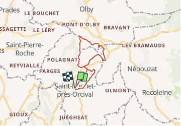
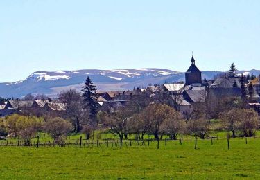
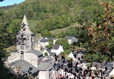
Trail Walking of 10.3 km to be discovered at Auvergne-Rhône-Alpes, Puy-de-Dôme, Saint-Bonnet-près-Orcival. This trail is proposed by tracegps.

Description

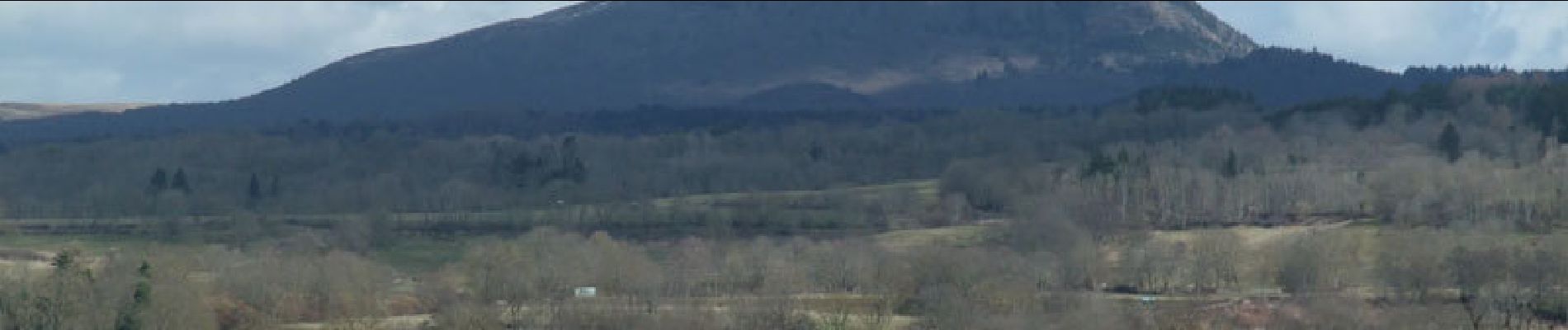
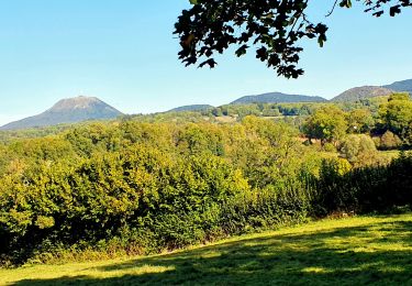
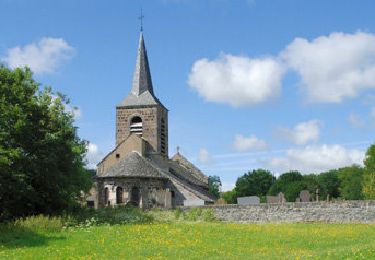
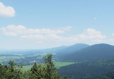
Le circuit emprunte de larges chemins tous très praticables par temps humide. Pas de boue aux chaussures!... A noter, en A (voir trace gpx) une belle croix de chemin d'origine religieuse, en B une vue inhabituelle du Puy de Dôme et en C un vieux pont de pierre sur la Sioule dont la largeur de passage n'excède pas 2 mètres.

Elevation profile

Photos

Points of interest

Point of interest Saint-Bonnet-près-Orcival - A - Photo
tracegps
SAINT-BONNET-PRÈS-ORCIVAL 
Point of interest Olby - B - Photo
tracegps
OLBY 
Point of interest Olby - C - Photo
tracegps
OLBY 

Positioning

Country:
France
Region :
Auvergne-Rhône-Alpes
Department/Province :
Puy-de-Dôme
Municipality :
Saint-Bonnet-près-Orcival
Location:
Unknown
Start:(UTM)
489054 ; 5061477 (31T) N.

Comments

Please log in to post a review or rate the element


les rives fe la Sioule


Trails nearby

Trail Walking Saint-Bonnet-près-Orcival - St_Bonnet_Orcival_Sioule - Photo
Walking
GUIDE
jagarnier

Walking

Easy
(1)
Saint-Bonnet-près-Orcival, Auvergne-Rhône-Alpes, Puy-de-Dôme, France
9.4 km | 11.8 km-effort
2h 45min
Yes
Trail Walking Saint-Pierre-Roche - St_Pierre_Roche_Sioulot - Photo
Walking
GUIDE
jagarnier

Walking

Easy
(1)
Saint-Pierre-Roche, Auvergne-Rhône-Alpes, Puy-de-Dôme, France
10.7 km | 13.2 km-effort
2h 51min
Yes
Trail On foot Olby - Boucle des dômes - Photo
On foot
PRO

On foot

Difficult
Olby, Auvergne-Rhône-Alpes, Puy-de-Dôme, France
24 km | 34 km-effort
7h 46min
No
Trail On foot Saint-Pierre-Roche - Le Sioulot - Photo
On foot
PRO

On foot

Easy
Saint-Pierre-Roche, Auvergne-Rhône-Alpes, Puy-de-Dôme, France
10 km | 12.3 km-effort
2h 47min
No
Trail On foot Rochefort-Montagne - Le Puy d'Ebert - Photo
On foot
PRO

On foot

Easy
Rochefort-Montagne, Auvergne-Rhône-Alpes, Puy-de-Dôme, France
9.4 km | 12.3 km-effort
2h 47min
No
Trail On foot Nébouzat - Le Puy de Pourcharet - Photo
On foot
PRO

On foot

Medium
Nébouzat, Auvergne-Rhône-Alpes, Puy-de-Dôme, France
19 km | 24 km-effort
5h 23min
Yes
Trail On foot Orcival - Bois des Bourelles - Photo
On foot
PRO

On foot

Easy
Orcival, Auvergne-Rhône-Alpes, Puy-de-Dôme, France
6.9 km | 10.1 km-effort
2h 17min
Yes
Trail Walking Aurières - Auriere_Gorce_Sioule - Photo
Walking
GUIDE
jagarnier

Walking

Medium
(1)
Aurières, Auvergne-Rhône-Alpes, Puy-de-Dôme, France
14.4 km | 19 km-effort
4h 15min
Yes
Trail Walking Orcival - Orcival_Bois_Bourelles - Photo
Walking
GUIDE
jagarnier

Walking

Easy
Orcival, Auvergne-Rhône-Alpes, Puy-de-Dôme, France
6.9 km | 10.1 km-effort
2h 0min
Yes


Close
My subscriptions