


Chouette Balade - Pont-à-Mousson - Bois Le Prêtre

edmondnagel
User
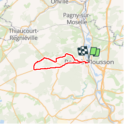

Length
29 km

Max alt
378 m

Uphill gradient
432 m
Km-Effort
35 km

Min alt
178 m

Downhill gradient
431 m
Boucle
No
Creation date :
2019-01-15 15:34:28.698
Updated on :
2019-01-15 15:34:28.698
2h00
Difficulty : Difficult

FREE GPS app for hiking
 SityTrail
IGN / Geographical institutes
SityTrail Plus
The world is yours!
About
Trail Cycle of 29 km to be discovered at Grand Est, Meurthe-et-Moselle, Pont-à-Mousson. This trail is proposed by edmondnagel.
Description
Chouette Balade - Pont-à-Mousson - Bois Le Prêtre
Positioning
Country:
France
Region :
Grand Est
Department/Province :
Meurthe-et-Moselle
Municipality :
Pont-à-Mousson
Location:
Unknown
Start:(Dec)
Start:(UTM)
283877 ; 5420594 (32U) N.
Comments