


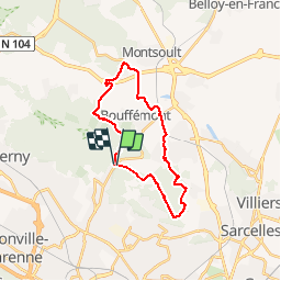

25 km | 31 km-effort


User


FREE GPS app for hiking
 SityTrail
IGN / Geographical institutes
SityTrail World
The world is yours!
Trail Walking of 22 km to be discovered at Ile-de-France, Val-d'Oise, Montlignon. This trail is proposed by tracegps.
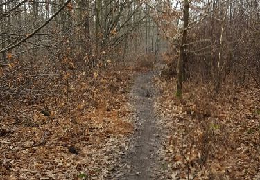
Départ du parking du Château de la Chasse. Traverser la D909 et prendre la route qui longe le golf de Domont (Route de la croix blanche) GRP ceinture verte de l'ile de France jusqu'à la D124 que l'on traverse.... Suivre les traces du GR/GRP jusqu'à Piscop puis continuer en direction de Domont. De Domont à Baillet, le circuit se déroule à travers champs. Passage boueux en fin de parcours, en redescendant vers le château de la Chasse.

Equestrian

Mountain bike
Walking

Walking
Walking
Walking
Walking
Walking
Walking