Trail Walking Mercatel - Mercatel Boisleux St Marc Boiry Becquerelle - Photo

Mercatel Boisleux St Marc Boiry Becquerelle

 tracegps
tracegps

User

© OpenStreetMap contributors
Length
Length
10.2 km
Max alt
Max alt
96 m
Uphill gradient
Uphill gradient
74 m
Km-Effort
Km-Effort  
11.2 km
Min alt
Min alt
67 m
Downhill gradient
Downhill gradient
74 m
Boucle
Boucle
Yes
Creation date :
2014-12-10 00:00:00.0
Updated on :
2014-12-10 00:00:00.0

(0 Reviews)

Walking
Walking
2h00
Difficulty : Medium

Scan this QR Code to open this trail in the SityTrail application

FREE GPS app for hiking

Logo SityTrail SityTrail

IGN / Geographical institutes

Download SityTrail from the App Store Download SityTrail from Google Play

Logo SityTrail SityTrail World

The world is yours!

Download SityTrail from the App Store Download SityTrail from Google Play Download SityTrail on Huawei AppGallery

About

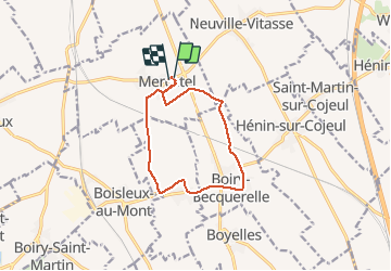
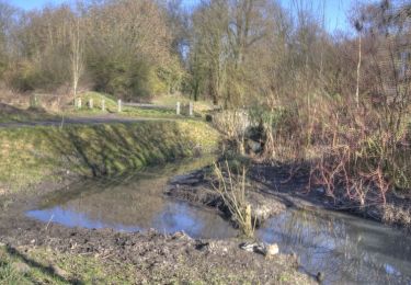
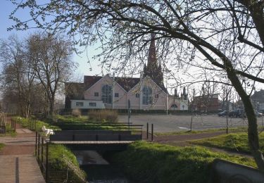
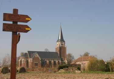
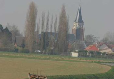
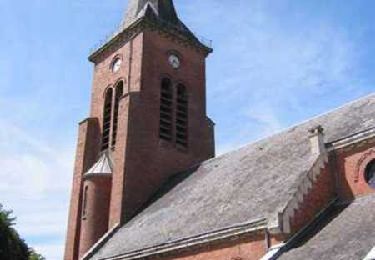
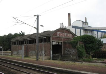
Trail Walking of 10.2 km to be discovered at Hauts-de-France, Pas-de-Calais, Mercatel. This trail is proposed by tracegps.

Description

Randonnée du club Arras Inter Générations au départ de Mercatel et qui passe par Boisleux St Marc Et Boiry Becquerelle.

Elevation profile

Positioning

Country:
France
Region :
Hauts-de-France
Department/Province :
Pas-de-Calais
Municipality :
Mercatel
Location:
Unknown
Start:(UTM)
485569 ; 5564852 (31U) N.

Trails nearby

Trail Walking Mercatel - Le chemin de Décauville  - Photo
Walking
tracegps

Walking

Medium
(1)
Mercatel, Hauts-de-France, Pas-de-Calais, France
8.8 km | 9.6 km-effort
2h 10min
Yes
Trail On foot Achicourt - la vallée du crinchon  - Photo
On foot
Templeuveenmarche

On foot

Easy
(1)
Achicourt, Hauts-de-France, Pas-de-Calais, France
10.7 km | 11.8 km-effort
2h 10min
Yes
Trail Walking Achicourt - Achicourt - Fossés de la Citadelle - Agny - Photo
Walking
tracegps

Walking

Medium
Achicourt, Hauts-de-France, Pas-de-Calais, France
10.7 km | 11.7 km-effort
2h 0min
Yes
Trail Walking Achicourt - Achicourt - Polygone - Wailly - Agny - Photo
Walking
tracegps

Walking

Medium
Achicourt, Hauts-de-France, Pas-de-Calais, France
11.1 km | 12.1 km-effort
2h 0min
Yes
Trail Walking Neuville-Vitasse - Le chemin de la crête Picarde - Neuville-Vitasse - Photo
Walking
tracegps

Walking

Medium
Neuville-Vitasse, Hauts-de-France, Pas-de-Calais, France
10.4 km | 11.4 km-effort
2h 40min
Yes
Trail Walking Beaurains - Le chemin du blanc miroir - Beaurains - Photo
Walking
tracegps

Walking

Difficult
Beaurains, Hauts-de-France, Pas-de-Calais, France
15.4 km | 16.9 km-effort
3h 55min
Yes
Trail Walking Boisleux-Saint-Marc - Sentier des Ecoliers - Boisleux Saint Marc - Photo
Walking
tracegps

Walking

Very difficult
Boisleux-Saint-Marc, Hauts-de-France, Pas-de-Calais, France
19.8 km | 22 km-effort
5h 0min
Yes
Trail Walking Boisleux-au-Mont - Boisleux au Mont - Hamelincourt - Boyelles - Boisleux Saint Marc - Photo
Walking
tracegps

Walking

Medium
Boisleux-au-Mont, Hauts-de-France, Pas-de-Calais, France
9.9 km | 10.9 km-effort
2h 0min
Yes
Trail Walking Achicourt - Achicourt - Moulin - Citadelle - Agny - Photo
Walking
tracegps

Walking

Medium
(1)
Achicourt, Hauts-de-France, Pas-de-Calais, France
10 km | 10.7 km-effort
2h 0min
Yes


Close
My subscriptions