marasse

doudet
User
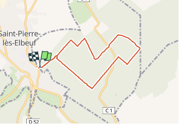

Length
7.6 km

Max alt
106 m

Uphill gradient
113 m
Km-Effort
9.1 km

Min alt
31 m

Downhill gradient
112 m
Boucle
Yes
Creation date :
2018-09-11 09:10:22.556
Updated on :
2018-09-11 09:10:22.556
1h55
Difficulty : Easy

FREE GPS app for hiking
 SityTrail
IGN / Geographical institutes
SityTrail Plus
The world is yours!
About
Trail Walking of 7.6 km to be discovered at Normandy, Eure, Martot. This trail is proposed by doudet.
Positioning
Country:
France
Region :
Normandy
Department/Province :
Eure
Municipality :
Martot
Location:
Unknown
Start:(Dec)
Start:(UTM)
358478 ; 5459061 (31U) N.
Comments