


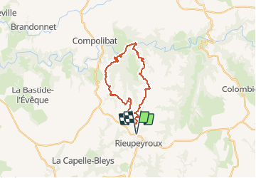
Rieupeyroux - Prévinquière

tracegps
User


7h00
Difficulty : Difficult

FREE GPS app for hiking
 SityTrail
IGN / Geographical institutes
SityTrail Plus
The world is yours!
About
Trail Walking of 23 km to be discovered at Occitania, Aveyron, Rieupeyroux. This trail is proposed by tracegps.
Description
Ce circuit relie Rieupeyroux à Prévinquière, sur la même commune, au fond de la vallée de l'Aveyron. C'est le plus long et difficile circuit proposé et balisé par le syndicat d'initiative de Rieupeyroux où on peut en acheter le guide. En VTT la remontée se fait sur un chemin relativement large mais extrêmement raide qui nécessite de pousser le vélo plusieurs fois sur les premiers 500m de la remontée.
Positioning
Comments