


Crête du mont macaron

Michelisabelle
User
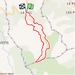

Length
6.8 km

Max alt
787 m

Uphill gradient
263 m
Km-Effort
10.3 km

Min alt
611 m

Downhill gradient
262 m
Boucle
Yes
Creation date :
2019-01-15 16:02:13.979
Updated on :
2019-01-15 16:02:13.979
2h08
Difficulty : Easy

FREE GPS app for hiking
 SityTrail
IGN / Geographical institutes
SityTrail Plus
The world is yours!
About
Trail Walking of 6.8 km to be discovered at Provence-Alpes-Côte d'Azur, Maritime Alps, Châteauneuf-Villevieille. This trail is proposed by Michelisabelle.
Positioning
Country:
France
Region :
Provence-Alpes-Côte d'Azur
Department/Province :
Maritime Alps
Municipality :
Châteauneuf-Villevieille
Location:
Unknown
Start:(Dec)
Start:(UTM)
362681 ; 4851121 (32T) N.
Comments