


Tour du Causse Méjean - Etape 4

nolsim
User
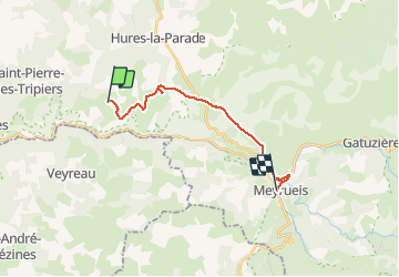

Length
15.7 km

Max alt
1015 m

Uphill gradient
234 m
Km-Effort
19.6 km

Min alt
700 m

Downhill gradient
482 m
Boucle
No
Creation date :
2019-01-15 16:02:35.136
Updated on :
2019-01-15 16:02:35.136
4h05
Difficulty : Easy

FREE GPS app for hiking
 SityTrail
IGN / Geographical institutes
SityTrail Plus
The world is yours!
About
Trail Walking of 15.7 km to be discovered at Occitania, Lozère, Hures-la-Parade. This trail is proposed by nolsim.
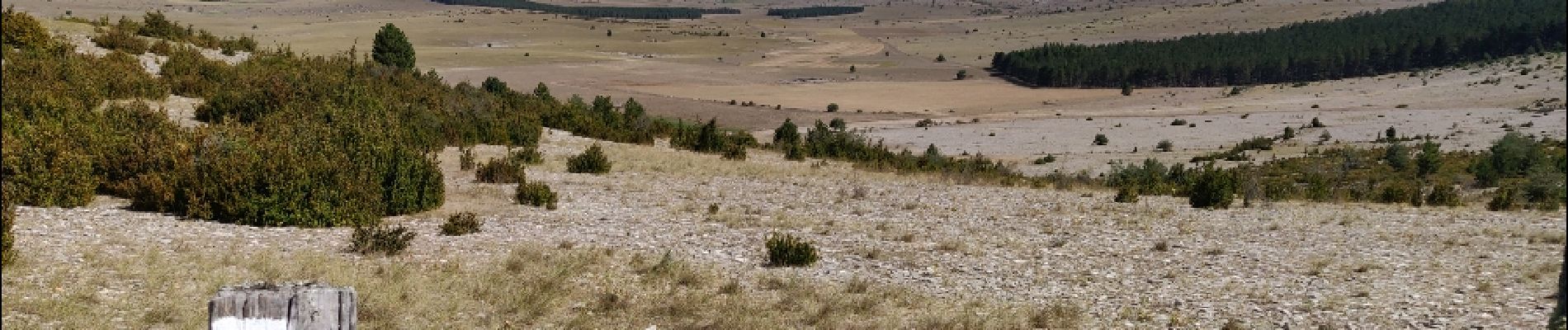
Description
Hyelzas - Meyrueis
Etape courte et sans difficulté. Profitez-en pour visiter l'Aven Armand
Photos


Positioning
Country:
France
Region :
Occitania
Department/Province :
Lozère
Municipality :
Hures-la-Parade
Location:
Unknown
Start:(Dec)
Start:(UTM)
525837 ; 4896029 (31T) N.
Comments