


la ternoise

jeanluc59
User

Length
8.6 km

Max alt
131 m

Uphill gradient
176 m
Km-Effort
11 km

Min alt
24 m

Downhill gradient
179 m
Boucle
Yes
Creation date :
2019-01-15 16:05:32.915
Updated on :
2019-01-15 16:05:32.915
2h28
Difficulty : Easy

FREE GPS app for hiking
 SityTrail
IGN / Geographical institutes
SityTrail Plus
The world is yours!
About
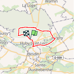
Trail Walking of 8.6 km to be discovered at Hauts-de-France, Pas-de-Calais, Huby-Saint-Leu. This trail is proposed by jeanluc59.
Positioning
Country:
France
Region :
Hauts-de-France
Department/Province :
Pas-de-Calais
Municipality :
Huby-Saint-Leu
Location:
Unknown
Start:(Dec)
Start:(UTM)
431316 ; 5581811 (31U) N.
Comments