


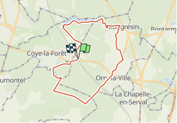
Forêt de Chantilly

philberard95
User

Length
15.7 km

Max alt
139 m

Uphill gradient
224 m
Km-Effort
18.7 km

Min alt
48 m

Downhill gradient
223 m
Boucle
Yes
Creation date :
2019-01-15 16:09:52.525
Updated on :
2023-01-11 13:01:46.984
--
Difficulty : Medium

FREE GPS app for hiking
 SityTrail
IGN / Geographical institutes
SityTrail Plus
The world is yours!
About
Trail Walking of 15.7 km to be discovered at Hauts-de-France, Oise, Orry-la-Ville. This trail is proposed by philberard95.
Description
Entre Coye-la-forêt et Orry-la-ville
Positioning
Country:
France
Region :
Hauts-de-France
Department/Province :
Oise
Municipality :
Orry-la-Ville
Location:
Unknown
Start:(Dec)
Start:(UTM)
462764 ; 5443105 (31U) N.
Comments