


Château de Puilaurens - Serre des Aiguilles

maupassant38
User
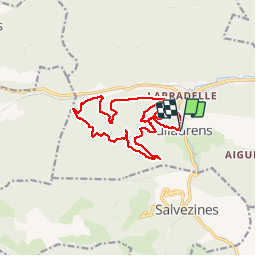

Length
16.3 km

Max alt
820 m

Uphill gradient
663 m
Km-Effort
25 km

Min alt
457 m

Downhill gradient
665 m
Boucle
Yes
Creation date :
2019-02-22 22:30:27.659
Updated on :
2019-02-22 22:30:27.683
3h45
Difficulty : Medium

FREE GPS app for hiking
 SityTrail
IGN / Geographical institutes
SityTrail Plus
The world is yours!
About
Trail Walking of 16.3 km to be discovered at Occitania, Aude. This trail is proposed by maupassant38.
Positioning
Country:
France
Region :
Occitania
Department/Province :
Aude
Municipality :
PUILAURENS
Location:
Unknown
Start:(Dec)
Start:(UTM)
443190 ; 4738897 (31T) N.
Comments