Trail Mountain bike Bellefontaine - Espace VTT FFC Chemins du Coeur des Vosges - circuit n°23 - Le Xaty - Photo

Espace VTT FFC Chemins du Coeur des Vosges - circuit n°23 - Le Xaty

 tracegps
tracegps

User

© OpenStreetMap contributors
Length
Length
12.2 km
Max alt
Max alt
624 m
Uphill gradient
Uphill gradient
191 m
Km-Effort
Km-Effort  
14.7 km
Min alt
Min alt
523 m
Downhill gradient
Downhill gradient
191 m
Boucle
Boucle
Yes
Creation date :
2014-12-10 00:00:00.0
Updated on :
2014-12-10 00:00:00.0

(2 Reviews)

Mountain bike
Mountain bike
49m
Difficulty : Easy

Scan this QR Code to open this trail in the SityTrail application

FREE GPS app for hiking

Logo SityTrail SityTrail

IGN / Geographical institutes

Download SityTrail from the App Store Download SityTrail from Google Play

Logo SityTrail SityTrail World

The world is yours!

Download SityTrail from the App Store Download SityTrail from Google Play Download SityTrail on Huawei AppGallery

About

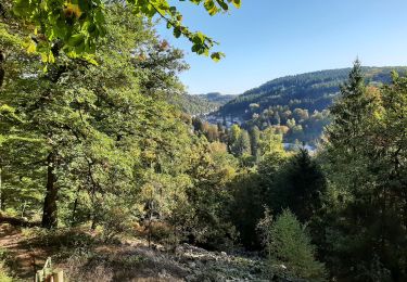
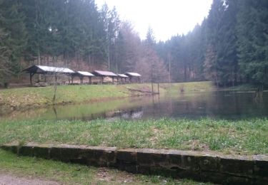
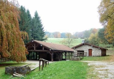
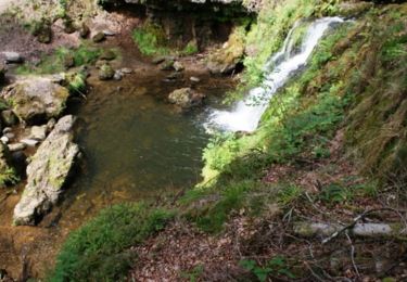
Trail Mountain bike of 12.2 km to be discovered at Grand Est, Vosges, Bellefontaine. This trail is proposed by tracegps.

Description

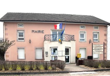
Espace VTT FFC Chemins du Cœur des Vosges - circuit n°23 - Le Xaty Circuit officiel labellisé par la Fédération Française de Cyclisme. Idéal pour une balade en famille ou pour débuter, ce circuit, au départ de Bellefontaine vous permet de découvrir tout en douceur les reliefs modulés du Pays de la Vôge.

Elevation profile

Photos

Positioning

Country:
France
Region :
Grand Est
Department/Province :
Vosges
Municipality :
Bellefontaine
Location:
Unknown
Start:(UTM)
309373 ; 5320938 (32U) N.

Comments

Please log in to post a review or rate the element


Trails nearby

Trail On foot Raon-aux-Bois - Raon-aux-Bois - Circuit 3 - Photo
On foot
PRO

On foot

Medium
Raon-aux-Bois, Grand Est, Vosges, France
14.8 km | 20 km-effort
4h 33min
Yes
Trail Nordic walking Plombières-les-Bains - plombieres20221008 - Photo
Nordic walking
demange gerald

Nordic walking

Very easy
Plombières-les-Bains, Grand Est, Vosges, France
19.6 km | 25 km-effort
3h 18min
Yes
Trail Walking Xertigny - l)Etapa 12 - Photo
Walking
RafaTuareg

Walking

Easy
Xertigny, Grand Est, Vosges, France
23 km | 30 km-effort
5h 2min
No
Trail Walking Bellefontaine - 26-10-19 Pierrache - Photo
Walking
annefrance70

Walking

Very easy
Bellefontaine, Grand Est, Vosges, France
7.5 km | 8.6 km-effort
1h 57min
Yes
Trail Walking Xertigny - Xertigny : circuit n'5 les granges Richard 10-05-19 - Photo
Walking
annefrance70

Walking

Easy
Xertigny, Grand Est, Vosges, France
9.4 km | 12.3 km-effort
2h 0min
Yes
Trail Walking Xertigny - Les Bois Beaudoin - Photo
Walking
jeanclaude12

Walking

Easy
Xertigny, Grand Est, Vosges, France
6.8 km | 9.2 km-effort
2h 43min
Yes
Trail Mountain bike Xertigny - Espace VTT FFC Chemins du Coeur des Vosges - circuit n°22 - La Hutte - Photo
Mountain bike
tracegps

Mountain bike

Medium
Xertigny, Grand Est, Vosges, France
10.3 km | 14.3 km-effort
49min
Yes
Trail Mountain bike Xertigny - Espace VTT FFC Chemins du Coeur des Vosges - circuit n°30 - Le Gué du Saut - Photo
Mountain bike
tracegps

Mountain bike

Difficult
Xertigny, Grand Est, Vosges, France
32 km | 40 km-effort
1h 45min
Yes
Trail Walking Xertigny - Cirkwi-Les_Granges_Richard - Photo
Walking
Emmanuel Remy

Walking

Medium
Xertigny, Grand Est, Vosges, France
9 km | 11.9 km-effort
2h 41min
Yes


Close
My subscriptions