Trail Mountain bike Condom-d'Aubrac - Site VTT FFC Aubrac - Vallée du Lot - Circuit n°5 - Les Enguilhens - Photo

Site VTT FFC Aubrac - Vallée du Lot - Circuit n°5 - Les Enguilhens

 tracegps
tracegps

User

© OpenStreetMap contributors
Length
Length
20 km
Max alt
Max alt
1302 m
Uphill gradient
Uphill gradient
476 m
Km-Effort
Km-Effort  
26 km
Min alt
Min alt
911 m
Downhill gradient
Downhill gradient
473 m
Boucle
Boucle
Yes
Creation date :
2014-12-10 00:00:00.0
Updated on :
2014-12-10 00:00:00.0

(1 Reviews)

Mountain bike
Mountain bike
1h40
Difficulty : Difficult

Scan this QR Code to open this trail in the SityTrail application

FREE GPS app for hiking

Logo SityTrail SityTrail

IGN / Geographical institutes

Download SityTrail from the App Store Download SityTrail from Google Play

Logo SityTrail SityTrail World

The world is yours!

Download SityTrail from the App Store Download SityTrail from Google Play Download SityTrail on Huawei AppGallery

About

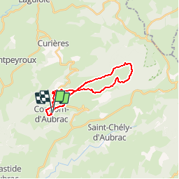
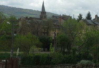
Trail Mountain bike of 20 km to be discovered at Occitania, Aveyron, Condom-d'Aubrac. This trail is proposed by tracegps.

Description

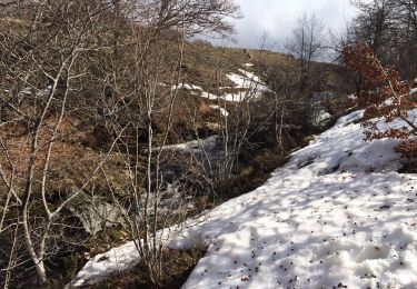
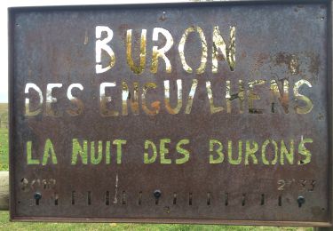
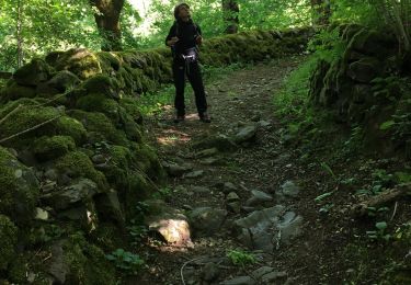
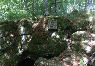
Site VTT FFC Aubrac – Vallée du Lot - Circuit n°5 - Les Enguilhens Circuit officiel labellisé par la Fédération Française de Cyclisme. Parcours roulant, longue montée physique, quelques passages rocheux, étroits et humides. Possibilité de petite boucle de 5 km avec retour sur Condom d’Aubrac. Attention en périodes de battues. Espace VTT ouvert d’Avril à Octobre. Renseignements : Office du Tourisme de St-Geniez-d'Olt - 4 Rue Cours - 12130 St-Geniez-d'Olt : 05 65 70 43 42.

Elevation profile

Photos

Positioning

Country:
France
Region :
Occitania
Department/Province :
Aveyron
Municipality :
Condom-d'Aubrac
Location:
Unknown
Start:(UTM)
489341 ; 4938971 (31T) N.

Comments

Please log in to post a review or rate the element


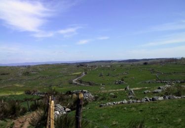
Excellent parcours très agréable


Trails nearby

Trail Walking Saint-Chély-d'Aubrac - La voie romaine - Saint Chély d'Aubrac - Photo
Walking
tracegps

Walking

Medium
(2)
Saint-Chély-d'Aubrac, Occitania, Aveyron, France
19 km | 28 km-effort
5h 30min
Yes
Trail Walking Saint-Chély-d'Aubrac - Saint Chely Espalion Avril 2018 - Photo
Walking
GUIDE
Kargil

Walking

Difficult
Saint-Chély-d'Aubrac, Occitania, Aveyron, France
25 km | 34 km-effort
7h 26min
No
Trail On foot Condom-d'Aubrac - Sentier Aubrac - Abbaye de Bonneval - Espalion - Photo
On foot
PRO

On foot

Easy
Condom-d'Aubrac, Occitania, Aveyron, France
12.8 km | 19.2 km-effort
4h 21min
No
Trail Walking Saint-Chély-d'Aubrac - S’y chely  - Photo
Walking
GUIDE
antignacs

Walking

Difficult
Saint-Chély-d'Aubrac, Occitania, Aveyron, France
22 km | 31 km-effort
6h 16min
Yes
Trail Walking Curières - Autour roquette bonneval deveze  - Photo
Walking
GUIDE
antignacs

Walking

Medium
Curières, Occitania, Aveyron, France
22 km | 30 km-effort
5h 55min
Yes
Trail Walking Saint-Chély-d'Aubrac - St chely Aubrac  - Photo
Walking
GUIDE
antignacs

Walking

Difficult
Saint-Chély-d'Aubrac, Occitania, Aveyron, France
21 km | 30 km-effort
6h 34min
Yes
Trail Walking Saint-Chély-d'Aubrac - CC_Velay_BC_07_St-Chely-Aubrac_Espalion_20070822 - Photo
Walking
patrickdanilo

Walking

Medium
Saint-Chély-d'Aubrac, Occitania, Aveyron, France
23 km | 31 km-effort
7h 30min
No
Trail Walking Saint-Chély-d'Aubrac - St chely d'aubrac - laguiole - Photo
Walking
prv

Walking

Very easy
Saint-Chély-d'Aubrac, Occitania, Aveyron, France
26 km | 37 km-effort
7h 48min
No
Trail Walking Saint-Chély-d'Aubrac - Saint Chely d'Aubrac - Saint Côme d'Olt - Photo
Walking
RR31

Walking

Medium
Saint-Chély-d'Aubrac, Occitania, Aveyron, France
18.1 km | 24 km-effort
5h 17min
No


Close
My subscriptions