


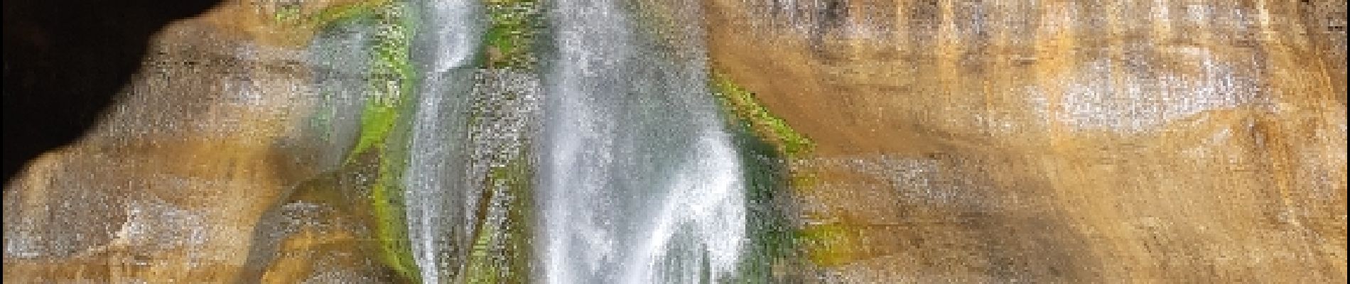
lower calf creek falls

phi14
User
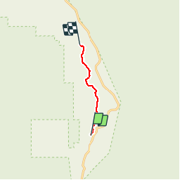

Length
5.3 km

Max alt
1776 m

Uphill gradient
253 m
Km-Effort
8.3 km

Min alt
1631 m

Downhill gradient
153 m
Boucle
No
Creation date :
2019-01-15 16:39:29.699
Updated on :
2019-01-15 16:39:29.699
1h47
Difficulty : Easy

FREE GPS app for hiking
 SityTrail
IGN / Geographical institutes
SityTrail Plus
The world is yours!
About
Trail Walking of 5.3 km to be discovered at Utah, Garfield County. This trail is proposed by phi14.
Description
Très belle balade avec à l'arrivée une superbe chute d'eau. 10.6 km AR
Photos


Positioning
Country:
United States
Region :
Utah
Department/Province :
Garfield County
Municipality :
Calf Creek Recreation Area
Location:
Unknown
Start:(Dec)
Start:(UTM)
463471 ; 4183027 (12S) N.
Comments